Oak Harbor in Island County, Washington — The American West (Northwest)
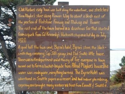
Oak Harbor’s Early “Town”
The east end of the town burned in a disastrous fire that started from a spark from Gil Kennedy’s blacksmith shop on a hot day in July 1920.
A good half the town went, Byrne’s hotel, Byrne’s store, the blacksmith shop, creamery, “Cap” Sill’s garage, and Dad Smith’s little house. There was no fire department and at the cry of “Fire” everyone in town turned out to form a bucket-brigade from Alfred Maylor’s house. The water was inadequate, everything burned. The Byrne Hotel was advertised in Seattle papers as a “resort” and had indoor plumbing, carpeting and brought many visitors via boat from Everett & Seattle.
Topics. This historical marker is listed in this topic list: Settlements & Settlers. A significant historical month for this entry is July 1920.
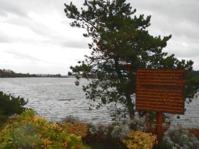
Location. 48° 17.37′ N, 122° 38.621′ W. Marker is in Oak Harbor, Washington, in Island County. Marker is at the intersection of SE Pioneer Way and SE Bayshore Drive on SE Pioneer Way. Touch for map. Marker is at or near this postal address: 1299 SE Pioneer Way, Oak Harbor WA 98277, United States of America. Touch for directions.
Other nearby markers. At least 8 other markers are within 6 miles of this marker, measured as the crow flies. Flintstone Park Flagpole (approx. ¼ mile away); Oak Harbor's Ties to the Sea (approx. 0.3 miles away); Beeksma’s Corner (approx. 0.7 miles away); U.S. Navy Patrol and Reconnaissance Memorial (approx. 3.8 miles away); The Skagit, a stately society (approx. 3.8 miles away); The Jolly Boat (approx. 5.1 miles away); Zylstra Law Office (approx. 5.1 miles away); Welcome (approx. 5.1 miles away). Touch for a list and map of all markers in Oak Harbor.
Credits. This page was last revised on October 14, 2020. It was originally submitted on November 8, 2012, by Barry Swackhamer of Brentwood, California. This page has been viewed 563 times since then and 16 times this year. Photos: 1, 2. submitted on November 8, 2012, by Barry Swackhamer of Brentwood, California. • Syd Whittle was the editor who published this page.

