Main/Military Plaza in San Antonio in Bexar County, Texas — The American South (West South Central)
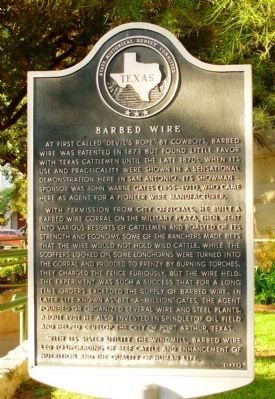
Barbed Wire
With permission from city officials, he built a barbed wire corral on the Military Plaza, then went into various resorts of cattlemen and boasted of its strength and economy. Some of the ranchers made bets that the wire would not hold wild cattle. While the scoffers looked on, some longhorns where turned into the corral and prodded to frenzy by burning torches. They charged the fence furiously, but the wire held. The experiment was such a success that for a long time orders exceeded the supply of barbed wire. In later life known as "bet-a-million" Gates, the agent founded or organized several wire and steel plants. About 1901 he also invested in Spindletop oil field and helped develop the city of Port Arthur, Texas.
With its sister utility the windmill, barbed wire led to upgrading of beef cattle and enhancement of nutrition and the quality of human life.
Erected 1971 by State Historical Survey Committee. (Marker Number 300.)
Topics. This historical marker is listed in these topic lists: Agriculture • Industry & Commerce. A significant historical year for this entry is 1873.
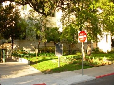
Location. 29° 25.461′ N, 98° 29.718′ W. Marker is in San Antonio, Texas, in Bexar County. It is in Main/Military Plaza. Marker is at the intersection of Dolorosa and Plaza de Armas, on the right when traveling west on Dolorosa. On the southwest corner of Military Plaza, grounds of San Antonio City Hall. Touch for map. Marker is at or near this postal address: 401 Dolorosa, San Antonio TX 78204, United States of America. Touch for directions.
Other nearby markers. At least 8 other markers are within walking distance of this marker. Flood of the Century (a few steps from this marker); Plaza de Armas (within shouting distance of this marker); Jose Francisco Ruiz (within shouting distance of this marker); Moses Austin (within shouting distance of this marker); Growth of a City (within shouting distance of this marker); Spanish Governor's Palace (within shouting distance of this marker); Zero Milestone Old Spanish Trail (within shouting distance of this marker); Urban Renewal and the Expansion of Government Buildings (about 300 feet away, measured in a direct line). Touch for a list and map of all markers in San Antonio.
Credits. This page was last revised on February 2, 2023. It was originally submitted on November 14, 2012, by Paul Fehrenbach of Germantown, Wisconsin. This page has been viewed 692 times since then and 18 times this year. Photos: 1, 2. submitted on November 14, 2012, by Paul Fehrenbach of Germantown, Wisconsin. • Bernard Fisher was the editor who published this page.

