Near Arpin in Wood County, Wisconsin — The American Midwest (Great Lakes)
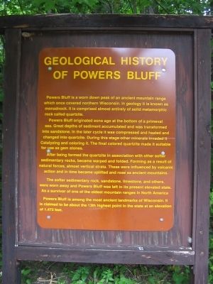
Geological History of Powers Bluff
Powers Bluff originated eons ago at the bottom of a primeval sea. Great depths of sediment accumulated and was transformed into sandstone. In the later cycle it was compressed and heated and changed into quartzite. During this stage other minerals invaded it Catalyzing and coloring it. The final colored quartzite made it suitable for use as gem stones.
After being formed the quartzite in association with other softer sedimentary rocks, became warped and folded. Forming as a result of natural forces, almost vertical strata. These were influenced by volcanic action and in time became uplifted and rose as ancient mountains.
The softer sedimentary rock, sandstone, limestone, and others, were worn away and Powers Bluff was left in its present elevated state. As a survivor of one of the oldest mountain ranges in North America Powers Bluff is among the most ancient landmarks of Wisconsin. It is claimed to be about the 13th highest point in the state at an elevation of 1,472 feet.
Topics. This historical marker is listed in these topic lists: Landmarks • Natural Features.
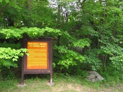
Location. 44° 31.765′ N, 90° 4.29′ W. Marker is near Arpin, Wisconsin, in Wood County. Marker can be reached from Bluff Drive west of County Highway E, on the right when traveling west. Marker is in Powers Bluff County Park, near the top of the bluff. Touch for map. Marker is in this post office area: Arpin WI 54410, United States of America. Touch for directions.
Other nearby markers. At least 8 other markers are within 10 miles of this marker, measured as the crow flies. Indian Dance Rings (within shouting distance of this marker); Powers Bluff (within shouting distance of this marker); Indian Bill Cemetery (approx. ¼ mile away); Slidre Evangelical Lutheran Church and Cemetery (approx. 5.7 miles away); City Founders’ Cemetery (approx. 6.7 miles away); Center of the State of Wisconsin (approx. 7 miles away); Prisoners of War (approx. 7.2 miles away); World's Largest Round Barn (approx. 9.9 miles away). Touch for a list and map of all markers in Arpin.
Credits. This page was last revised on June 16, 2016. It was originally submitted on March 10, 2008, by Keith L of Wisconsin Rapids, Wisconsin. This page has been viewed 2,521 times since then and 52 times this year. Photos: 1, 2, 3. submitted on March 10, 2008, by Keith L of Wisconsin Rapids, Wisconsin. • J. J. Prats was the editor who published this page.


