Roanoke in Huntington County, Indiana — The American Midwest (Great Lakes)
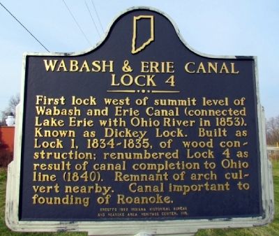
Wabash & Erie Canal Lock 4
Erected 1997 by Indiana Historical Bureau and Roanoke Area Heritage Center, Inc. (Marker Number 35.1997.1.)
Topics and series. This historical marker is listed in these topic lists: Industry & Commerce • Waterways & Vessels. In addition, it is included in the Indiana Historical Bureau Markers, and the Wabash & Erie Canal series lists.
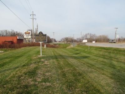
Location. 40° 57.705′ N, 85° 22.271′ W. Marker is in Roanoke, Indiana, in Huntington County. Marker is at the intersection of E. First St and US 24 on E. First St. Marker is located next to the PNC Bank parking lot. Touch for map. Marker is at or near this postal address: 339 E First St, Roanoke IN 46783, United States of America. Touch for directions.
Other nearby markers. At least 8 other markers are within 9 miles of this marker, measured as the crow flies. The Hartleys (about 700 feet away, measured in a direct line); Kiilhsoohkwa (Kilsoquah) (approx. ¾ mile away); Fred A. Loew (approx. 7.8 miles away); a different marker also named Fred A. Loew (approx. 7.8 miles away); The Little River Valley Story (approx. 8.3 miles away); Huntington County Civil War Memorial (approx. 8.3 miles away); Huntington High School / General James R. Slack 1818 - 1881 (approx. 8.3 miles away); Old Plat Historic District (approx. 8.4 miles away). Touch for a list and map of all markers in Roanoke.
Also see . . . Wabash and Erie Canal - Wikipedia entry. (Submitted on December 12, 2013.)
Credits. This page was last revised on August 30, 2020. It was originally submitted on November 15, 2012, by Duane Hall of Abilene, Texas. This page has been viewed 593 times since then and 16 times this year. Photos: 1, 2. submitted on November 15, 2012, by Duane Hall of Abilene, Texas. • Bill Pfingsten was the editor who published this page.

