Sierra City in Sierra County, California — The American West (Pacific Coastal)
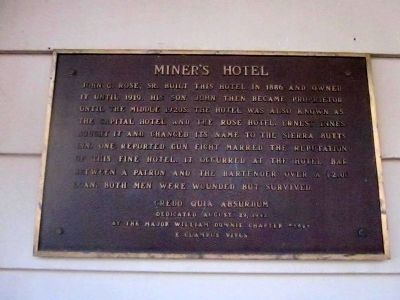
Miner’s Hotel
Photographed by Syd Whittle, October 14, 2012
1. Miner’s Hotel Marker
Erected 1992 by Major William Downie Chapter 1849, E Clampus Vitus.
Topics and series. This historical marker is listed in this topic list: Notable Buildings. In addition, it is included in the E Clampus Vitus series list. A significant historical year for this entry is 1886.
Location. 39° 33.928′ N, 120° 38.169′ W. Marker is in Sierra City, California, in Sierra County. It is at the intersection of Golden Chain Highway (State Highway 49) and Hayes Road, on the right when traveling north on Golden Chain Highway. Touch for map. Marker is at or near this postal address: 215 California 49, Sierra City CA 96125, United States of America. Touch for directions.

Regionally, this marker
this page online
Other nearby markers. At least 8 other markers are within 10 miles of this marker, measured as the crow flies: Busch & Heringlake Building (about 600 feet away, measured in a direct line); Memorial (approx. 0.9 miles away); Here Today – Gone Tomorrow (approx. 1.4 miles away); Site of Howard Ranch and Inn (approx. 4.3 miles away); Crossing the Summit - Weather or Not (approx. 8.6 miles away); Cornish Ranch House (approx. 8.9 miles away); Downieville Cemetery (approx. 10.1 miles away); Downieville Foundry (approx. 10.1 miles away). Touch for a list and map of all markers in Sierra City.
Another marker is no longer nearby. Food for the Mines (was approx. 8.6 miles away but has been replaced with another marker now near it).
Photographed by Syd Whittle, October 14, 2012
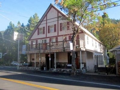
2. Miner’s Hotel and Marker
The marker is visible at the far left of the front of the building.
Credits. This page was last revised on June 16, 2016. It was originally submitted on November 15, 2012, by Syd Whittle of Mesa, Arizona. This page has been viewed 653 times since then and 24 times this year. Photos: 1, 2. submitted on November 15, 2012, by Syd Whittle of Mesa, Arizona.
