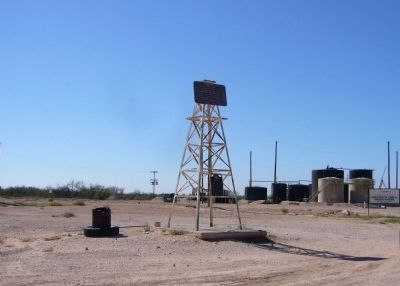
Near Andrews in Andrews County, Texas — The American South (West South Central)
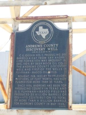
Andrews County Discovery Well
(˝ mi. S, & ˝ mi. W.)
Bought, Feb. 1932, by Tripplehorn brothers, of Fort Worth. Has now pumped for more than 35 years.
Since 1956, Andrews has been top producing county in Texas and U.S. Fuhrman-Masco field has produced 55 million barrels of oil--its contribution to total of more than a billion barrels for Andrews County in May, 1965.
Erected 1965 by Texas Historical Commission. (Marker Number 168.)
Topics. This historical marker is listed in this topic list: Industry & Commerce. A significant historical month for this entry is May 1965.
Location. 32° 20.023′ N, 102° 39.477′ W. Marker is near Andrews, Texas, in Andrews County. Marker is at the intersection of Eunice Highway (State Highway 176) and SW 3001, on the left when traveling west on Eunice Highway. Touch for map. Marker is in this post office area: Andrews TX 79714, United States of America. Touch for directions.
Other nearby markers. At least 8 other markers are within 7 miles of this marker, measured as the crow flies. Shafter Lake Townsite (approx. 5.1 miles away); Dorsie M. Pinnell (approx. 5.8 miles away); Original Townsite of Andrews (approx. 6.1 miles away); The J. S. Means Ranch House (approx. 6.1 miles away); Early Settlers (approx. 6.1 miles away); Korean War (approx. 6.2 miles away); World War I (approx. 6.2 miles away); American Civil War / Spanish American War (approx. 6.2 miles away). Touch for a list and map of all markers in Andrews.
Credits. This page was last revised on June 16, 2016. It was originally submitted on November 25, 2012, by Bill Kirchner of Tucson, Arizona. This page has been viewed 1,858 times since then and 109 times this year. Photos: 1, 2. submitted on November 25, 2012, by Bill Kirchner of Tucson, Arizona. • Bernard Fisher was the editor who published this page.

