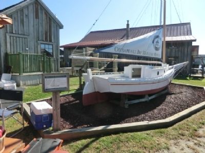
Miniature Skipjack, Spat
Chesapeake Bay Maritime Museum
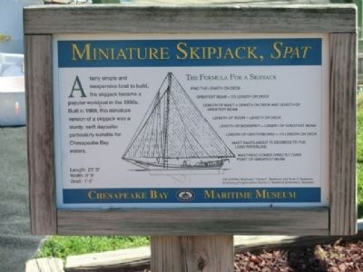
Length: 23’3”, Width: 6’8”, Draft: 1’6”
The Formula for a Skipjack—
Find the length on deck; Greatest Beam=1/3 length of deck; Length of Boom=Length of Deck; Length of Centerboard=1/5 length on deck; Mast rakes about 75 degrees to the load waterline; Masthead comes directly over point of greatest beam
Topics. This historical marker is listed in this topic list: Waterways & Vessels. A significant historical year for this entry is 1969.
Location. Marker has been reported permanently removed. It was located near 38° 47.238′ N, 76° 13.17′ W. Marker was in St. Michaels, Maryland, in Talbot County. It was on North Talbot Street. This marker is on the grounds of the Chesapeake Maritime Museum. Touch for map. Marker was in this post office area: Saint Michaels MD 21663, United States of America.
We have been informed that this marker is no longer there and will not be replaced.
this page online
Regionally, this marker was on the Eastern Shore. It was also in the American Mid-Atlantic, on the Delmarva Peninsula, in the Tidewater, in the Chesapeake Bay Region, and on the Eastern Seaboard. Globally, it was in the North Atlantic Region, North America, the Western Hemisphere, the Western World, and the Anglosphere. Historically, it found itself in what was once one of the original Thirteen Colonies and also the Antebellum South.

Other nearby markers. At least 8 other markers are within walking distance of this location: Too Much of a Good Thing (a few steps from this marker); Delaware (a few steps from this marker); Dorothy Lee (a few steps from this marker); Rebuilding Rosie Parks (a few steps from this marker); Iconic Chesapeake Light (within shouting distance of this marker); Point Lookout Fog Bell Tower (within shouting distance of this marker); 1879 Hooper Strait Lighthouse (within shouting distance of this marker); How the Screwpile Lighthouse Got Its Name (within shouting distance of this marker). Touch for a list and map of all markers in St. Michaels.
Other
Related marker. Click here for another marker that is related to this marker. This marker has been replaced by the linked marker.
Credits. This page was last revised on August 26, 2019. It was originally submitted on November 29, 2012, by Don Morfe of Baltimore, Maryland. This page has been viewed 544 times since then and 17 times this year. Photos: 1, 2, 3. submitted on November 29, 2012, by Don Morfe of Baltimore, Maryland. • Bill Pfingsten was the editor who published this page.
