Marker Logo HMdb.org THE HISTORICAL
MARKER DATABASE
“Bite-Size Bits of Local, National, and Global History”
Oroville in Butte County, California — The American West (Pacific Coastal)
 

Bidwell Bar Bridge and Tollhouse


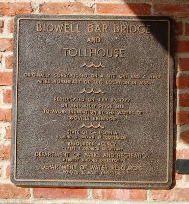
Bidwell Bar Bridge and Tollhouse Marker image. Click for full size.
Photographed By Barry Swackhamer, November 15, 2012
1. Bidwell Bar Bridge and Tollhouse Marker
Inscription.
Originally constructed on a site one and a half miles northeast of this location in 1856

Rededicated on July 30, 1977
on this Kelly Ridge site
to avoid inundation by the waters of
Oroville Reservoir

State of California - Edmund G. Brown Jr., Governor
Resources Agency – Claire T. Dedrick, Secretary
Department of Parks and Recreation – Herbert Rhodes, Director
Department of Water Resources – Ronald B. Robie, Director

 
Erected 1977 by California Department of Parks and Recreation.
 
Topics. This historical marker is listed in this topic list: Bridges & Viaducts. A significant historical month for this entry is July 1856.
 
Location. 39° 32.246′ N, 121° 27.292′ W. Marker is in Oroville, California, in Butte County. Marker is on Bidwell Canyon Road. This marker is located in the parking lot of the Bidwell Bar Boat Launch at the end of Bidwell Canyon Road. Touch for map. Marker is in this post office area: Oroville CA 95966, United States of America. Touch for directions.
 
Other nearby markers. At least 8 other markers are within 4 miles of this marker, measured as the crow flies. Bidwell's Bar (a few steps from this marker); The Mother Orange Tree of Butte County (a few steps from this marker); Autumn Harvest (approx. 0.6 miles away); Oroville Dam (approx. 2 miles
Paid Advertisement
Click on the ad for more information.
Please report objectionable advertising to the Editor.
Click or scan to see
this page online
away); a different marker also named Mother Orange Tree of Butte County (approx. 3.2 miles away); Northern California's Oldest Citrus Tree (approx. 3.2 miles away); Long's Bar (approx. 3.7 miles away); Morris Ravine School (approx. 3.9 miles away). Touch for a list and map of all markers in Oroville.
 
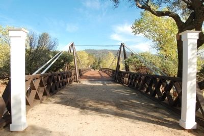
More about this marker. Before Lake Oroville inundated Bidwell Bar the bridge was disassembled and reconstructed at this location.
 
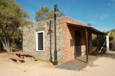
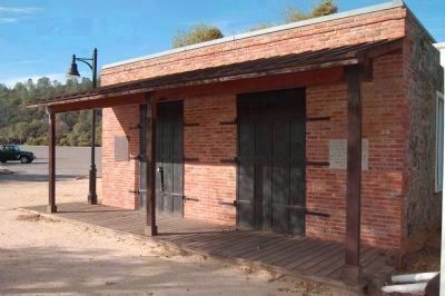
Bidwell Bar BridgeTollhouse (Replica) image. Click for full size.
Photographed By Barry Swackhamer, November 15, 2012
2. Bidwell Bar BridgeTollhouse (Replica)
This marker is seen on the left of the entrance doors and the N.S.G.W/N.D.G.W Centennial dedication plaque is seen on the right.
Bidwell Bar Bridge and Tollhouse Marker image. Click for full size.
Photographed By Barry Swackhamer, November 15, 2012
3. Bidwell Bar Bridge and Tollhouse Marker
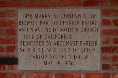
Centennial Dedication Plaque image. Click for full size.
Photographed By Barry Swackhamer
4. Centennial Dedication Plaque
1956 marks 1st centennial of Bidwell Bar Suspension Bridge and planting of Mother Orange Tree of California
Dedicated by Argonaut Parlor No. 8, Native Sons of the Golden West & Gold of Ophir Parlor No. 190, Native Daughters of the Golden West
May 19, 1956
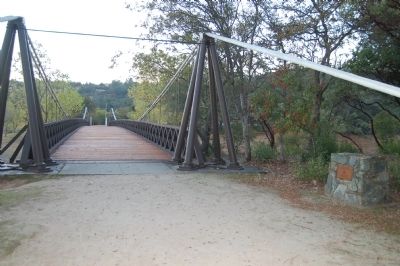
Bidwell Bar Suspension Bridge image. Click for full size.
Photographed By Barry Swackhamer, November 15, 2012
5. Bidwell Bar Suspension Bridge
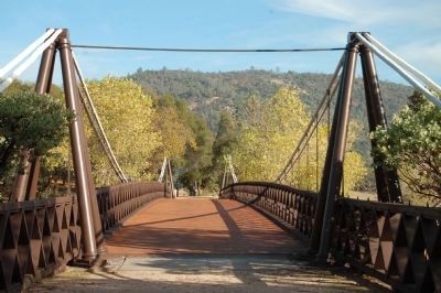
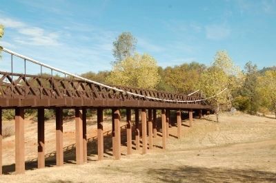
Bidwell Bar Suspension Bridge image. Click for full size.
Photographed By Barry Swackhamer, November 15, 2012
6. Bidwell Bar Suspension Bridge
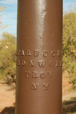
Bidwell Bar Suspension Bridge, detail of cable support image. Click for full size.
Photographed By Barry Swackhamer, November 15, 2012
7. Bidwell Bar Suspension Bridge, detail of cable support
Bidwell Bar Suspension Bridge image. Click for full size.
Photographed By Barry Swackhamer, November 14, 2012
8. Bidwell Bar Suspension Bridge
The monument on the right reads, "National Historic Civil Engineering Landmark,Bidwell Bar Suspension Bridge, Designated 1967."
The Bidwell Bar Suspension Bridge at its Original Site image. Click for full size.
9. The Bidwell Bar Suspension Bridge at its Original Site
 
 
Credits. This page was last revised on July 27, 2018. It was originally submitted on December 5, 2012, by Barry Swackhamer of Brentwood, California. This page has been viewed 868 times since then and 37 times this year. Photos:   1, 2, 3, 4, 5, 6, 7, 8, 9. submitted on December 5, 2012, by Barry Swackhamer of Brentwood, California. • Syd Whittle was the editor who published this page.
Share this page.  
Share on Tumblr
m=61597

CeraNet Cloud Computing sponsors the Historical Marker Database.
This website earns income from purchases you make after using our links to Amazon.com. We appreciate your support.
Paid Advertisement
Apr. 23, 2024