Kingsbury in Washington County, New York — The American Northeast (Mid-Atlantic)
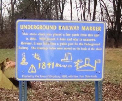
Underground Railway Marker
Erected 1999 by Town of Kingsbury.
Topics. This historical marker is listed in this topic list: Abolition & Underground RR. A significant historical year for this entry is 1841.
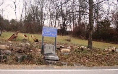
Location. 43° 22.4′ N, 73° 33′ W. Marker is in Kingsbury, New York, in Washington County. Marker is on County Route 36, 1.9 miles west of U.S. 4, on the left when traveling east. Touch for map. Marker is in this post office area: Hudson Falls NY 12839, United States of America. Touch for directions.
Other nearby markers. At least 8 other markers are within 4 miles of this marker, measured as the crow flies. Vaughn's Corners (approx. 0.7 miles away); Burgoyne's Army (approx. 1.2 miles away); Kingsbury Street (approx. 1.2 miles away); Patten's Mills Cemetery (approx. 2.3 miles away); Great Indian Warpath (approx. 2.9 miles away); Smith's Basin (approx. 3 miles away); Oneida (approx. 4 miles away); Hamilton Lodge 144 F & A M (approx. 4 miles away). Touch for a list and map of all markers in Kingsbury.
Also see . . . The Underground Railroad in New York State. New York History Net's page to, "...catalogue information on the People and Places of New York that were involved in the activities of the Underground Railroad, and to provide reliable information about their role in African Americans' struggle for freedom." (Submitted on December 11, 2012.)
Additional commentary.
1. From The Underground Railroad in Northern New York, by Tom Calarco
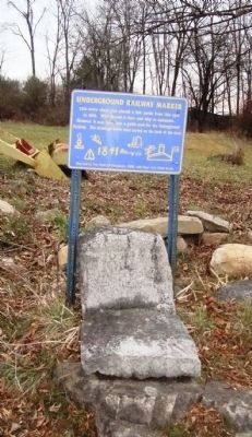
...This relic had other markings mostly worn away by time and formerly rested on small legs. Many believed it served as a map for fugitive slaves traveling the Underground Railroad. A drawing of the chair as it looked in the 1930's made by George LaMere has been preserved by his nephew, Kingsbury historian Paul Loding, who believes he can decipher the markings. Loding suggests that what looks like a fort with a flag represents the village of Fort Ann and its Underground Railroad stations of legend, the Goodman Farm and the Old Stone Library; the triangular shape, Putnam Mountain; the smokestack above it, the Mt. Hope Blast Furnace that was north of the mountain; and the sailboat in the top right corner, the inlet to Lake Champlain...
— Submitted December 11, 2012.
Credits. This page was last revised on June 16, 2016. It was originally submitted on December 8, 2012, by John Arsenault of Middletown Springs, Vermont. This page has been viewed 1,468 times since then and 101 times this year. Photos: 1, 2, 3. submitted on December 8, 2012, by John Arsenault of Middletown Springs, Vermont. • Bill Pfingsten was the editor who published this page.


