Stirling City in Butte County, California — The American West (Pacific Coastal)
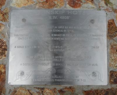
Inskip Hotel
Elev. 4808’
Editor's Note: All the "E's" on this marker are backwards
The historic inn, first built in 1857 by Pat Kelley sold to John Stokes in 1866.
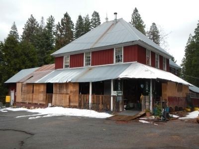
Destroyed by fire in 1868. Rebuilt in 1868, is the only remaining one of five hotels which served the Inskip mining district.
A gold strike in the early 1850’s brought in a population of over one thousand by 1860.
Inskip was the major midway station on the old Oroville-Susanville-Honey Lake Road.
A distance of about 140 rugged miles of dust and mud.
Erected 1974 by E Clampus Vitus, Pair-O-Dice Chapter No. 7-11.
Topics and series. This historical marker is listed in these topic lists: Industry & Commerce • Notable Buildings. In addition, it is included in the E Clampus Vitus series list. A significant historical year for this entry is 1857.
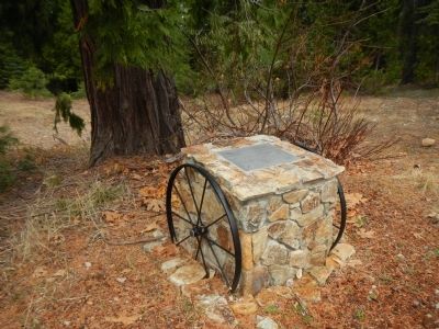
Location. 39° 59.434′ N, 121° 32.501′ W. Marker is in Stirling City, California, in Butte County. Marker is at the intersection of Skyway Highway, on the left when traveling north on Skyway Highway. This marker is across from the hotel. Touch for map. Marker is at or near this postal address: 18735 Skyway Highway, Stirling City CA 95978, United States of America. Touch for directions.
Other nearby markers. At least 8 other markers are within 13 miles of this marker, measured as the crow flies. Stirling City (approx. 6.1 miles away); Katie Thompson – Mattie Thompson – Josie Campbell (approx. 6.3 miles away); Lovelock (approx. 7.1 miles away); Old Lake House (approx. 8.2 miles away); 14 Mile House (approx. 12.6 miles away); Magalia Community Church / The Magalia Schoolhouse Bell (approx. 12.8 miles away); Dogtown (approx. 12.8 miles away); The Dogtown Nugget (approx. 13 miles away).
Credits. This page was last revised on June 16, 2016. It was originally submitted on December 12, 2012, by Barry Swackhamer of Brentwood, California. This page has been viewed 700 times since then and 40 times this year. Photos: 1, 2, 3, 4. submitted on December 12, 2012, by Barry Swackhamer of Brentwood, California. • Syd Whittle was the editor who published this page.


