Annapolis in Anne Arundel County, Maryland — The American Northeast (Mid-Atlantic)
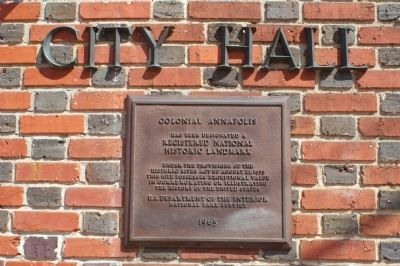
Colonial Annapolis
Registered National
Historic Landmark
Under the provisions of the
Historic Sites Act of August 21, 1935.
This site possesses exceptional value
in commemorating or illustrating
the history of the United States
U.S. Department of the Interior
National Park Service
1965
Erected 1965 by National Park Service - United States Department of the Interior.
Topics and series. This historical marker is listed in these topic lists: Architecture • Colonial Era • Landmarks • Settlements & Settlers. In addition, it is included in the National Historic Landmarks series list. A significant historical year for this entry is 1935.
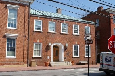
Location. 38° 58.585′ N, 76° 29.368′ W. Marker is in Annapolis, Maryland, in Anne Arundel County. Marker is on Duke of Gloucester Street, on the left when traveling south. Touch for map. Marker is in this post office area: Annapolis MD 21401, United States of America. Touch for directions.
Other nearby markers. At least 8 other markers are within walking distance of this marker. This tablet (a few steps from this marker); Maynard-Burgess House (within shouting distance of this marker); First Presbyterian Church of Annapolis (within shouting distance of this marker); Mann's Tavern (about 400 feet away, measured in a direct line); First Synagogue in Annapolis (about 400 feet away); 159 Main Street (about 500 feet away); Gov. Francis Nicholson (about 500 feet away); 167 Main Street at Conduit Street (about 500 feet away). Touch for a list and map of all markers in Annapolis.
Credits. This page was last revised on August 28, 2020. It was originally submitted on March 14, 2008, by Christopher Busta-Peck of Shaker Heights, Ohio. This page has been viewed 2,253 times since then and 12 times this year. Photos: 1, 2. submitted on March 14, 2008, by Christopher Busta-Peck of Shaker Heights, Ohio.

