Near El Centro in Imperial County, California — The American West (Pacific Coastal)
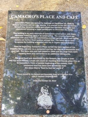
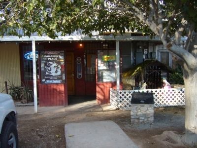
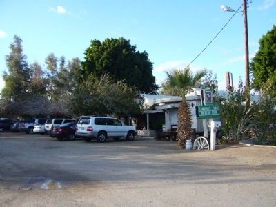
Camacho's Place and Café
The building is an early example of sustainable construction, with many discarded materials used in its construction. The concrete floors are reinforced with steel from old automobiles and bed springs. Walls and ceiling beams are formed from surplus railroad ties. The heavy doors used to secure the building originated with the El Centro railroad station.
From its beginning, Camacho's Place served the farm workers of the Imperial Valley, not only as a restaurant and bar but also as a mercantile and pool hall. The store and pool hall closed in 1964 and the large front room housing them was converted to an additional dining area.
The good food was discovered by the farmers, the people in town and local military. Locals can count on meeting their friends when they go to Camacho's. From a humble beginning in the country, their renowned food has been sent worldwide from the place that is "hard to find but worth it".
Erected 2010 by the Ancient and Honorable Order of E Clampus Vitus.
Topics and series. This historical marker is listed in these topic lists: Industry & Commerce • Notable Buildings. In addition, it is included in the E Clampus Vitus series list. A significant historical month for this entry is December 1933.
Location. 32° 43.418′ N, 115° 36.147′ W. Marker is near El Centro, California, in Imperial County. Marker is at the intersection of West Wahl Road and Nichols Road, on the right when traveling west on West Wahl Road. Touch for map. Marker is in this post office area: El Centro CA 92243, United States of America. Touch for directions.
Other nearby markers. At least 8 other markers are within 8 miles of this marker, measured as the crow flies. Rock Art (approx. 5.2 miles away); Mormon Battalion (approx. 5.2 miles away); Yuha Well (approx. 5.2 miles away); Women's 10,000 Club (approx. 5.3 miles away); Imperial Valley Press (approx. 5.4 miles away); Hotel De Anza (approx. 7.3 miles away); Camp Salvation (approx. 7.4 miles away); Calexico Carnegie Library (approx. 7.4 miles away). Touch for a list and map of all markers in El Centro.
Credits. This page was last revised on June 16, 2016. It was originally submitted on December 23, 2012, by Bill Kirchner of Tucson, Arizona. This page has been viewed 864 times since then and 44 times this year. Photos: 1, 2, 3. submitted on December 23, 2012, by Bill Kirchner of Tucson, Arizona. • Syd Whittle was the editor who published this page.


