Downtown Silver Spring in Montgomery County, Maryland — The American Northeast (Mid-Atlantic)
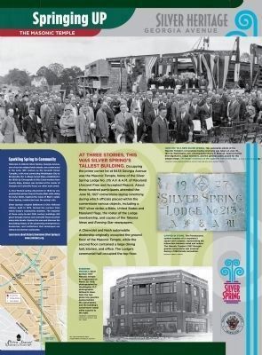
Springing Up
Masonic Temple
— Silver Heritage Georgia Avenue —
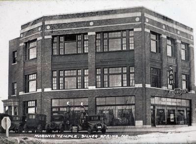
A Chevrolet and Nash automobile dealership originally occupied the ground floor of the Masonic Temple, while the second floor contained a large dining hall, kitchen, and office. The Lodge's ceremonial hall occupied the top floor.
Sparkling Spring to Community
Welcome to the Silver Spring, Georgia Avenue, one of our two original main streets, was constructed in the 19th century as the Seventh Street Turnpike, a dirt road connecting Washington City to Brookeville, Md. A village named Sligo, was established in the 1830s by Chesapeake and Ohio Canal workers from County Sligo, Ireland, was located at the corner of Georgia and Colesville Road, our other main street. A mica-flecked spring discovered in 1840 by U.S. presidential advisor Francis Preston Blair while riding his horse Selim, inspired the name of Blair's estate Silver Spring, constructed near the spring's site.
Silver Spring's original Baltimore and Ohio Railroad station , built in 1878, formed the nucleus from which today's community radiated. The majority of these early-to-mid century buildings still grace Georgia Avenue and Colesville Road and their many side streets. Explore the area and discover the fascinating history of the pioneering entrepreneurs, businesses, and institutions that developed our vibrant and diverse community.
Learn more about Historic Downtown Silver Spring at www.sshistory.org
Topics and series. This historical marker is listed in this topic list: Settlements & Settlers. In addition, it is included in the Baltimore and Ohio Railroad (B&O), and the Chesapeake and Ohio (C&O) Canal series lists. A significant historical month for this entry is June 1789.
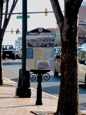
Location. 38° 59.649′ N, 77° 1.594′ W. Marker is in Silver Spring, Maryland, in Montgomery County. It is in Downtown Silver Spring. Marker is at the intersection of Georgia Avenue (Maryland Route 97) and Wayne Avenue on Georgia Avenue. The marker is on the south west corner of Georgia Avenue. Touch for map. Marker is in this post office area: Silver Spring MD 20910, United States of America. Touch for directions.
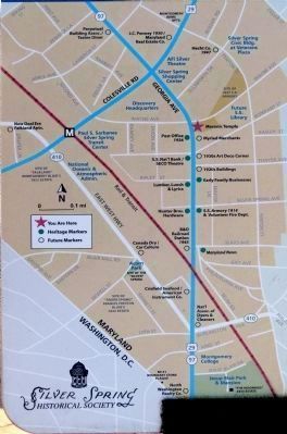
Other nearby markers. At least 8 other markers are within walking distance of this marker. A Community Grows (here, next to this marker); A New Deal in Town (within shouting distance of this marker); You Are Here - 1931 (within shouting distance of this marker); The Global Refugee Mural (within shouting distance of this marker); Silver Spring Armory (about 300 feet away, measured in a direct line); First Bank, First Heist (about 300 feet away); Spirited Entertainment (about 300 feet away); Silver Spring Shopping Center (about 600 feet away). Touch for a list and map of all markers in Silver Spring.
Related markers. Click here for a list of markers that are related to this marker. These two markers are back to back on the same post.
Also see . . . www.sshistory.org. This URL appears on the marker. (Submitted on December 24, 2012, by Allen C. Browne of Silver Spring, Maryland.)
Photographed By Allen C. Browne, December 22, 2012
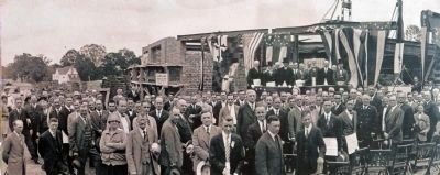
4. Panoramic Photo
Hats off to a new Silver Spring. This panoramic photo of the Masonic Temple's cornerstone-laying ceremony was taken on June 18, 1927 by D.C. photographer Harry H. Rideout. Approximately 300 dignitaries, lodge members, and th egeneral public posed for this unique image. The image continues on t he opposite side of this sign....
Courtesy Silver Spring Historical Society and William H.Packett Family
Photographed By Allen C. Browne, December 22, 2012
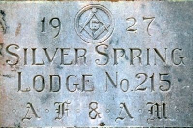
5. Carved in Stone.
The Freemasonry symbol consists of a carpenter's square and compass, representing the interaction between mind and matter. The Masonic Temple's 1927 Georgia granite cornerstone was covered during a 1998 facade renovation.
Standing Proudly. Photo by Jerry A. McCoy
Photographed By Allen C. Browne, December 22, 2012
6. Silver Spring's 1927 Masonic Temple
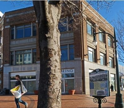
Silver Spring's 1927 Masonic Temple as it appeared on March 28, 1928, photographed by Washington D.C. photographer Willard R. Ross. The structure was designed by renowned Washington D.C. area architect and Silver Spring resident Howard Wright Cutler. Note the two globe-topped gasoline pumps behind the automobiles and the building's corner stone (small white square) to the right. Courtesy Silver Spring Historical Society and Guy Jones
Credits. This page was last revised on May 25, 2023. It was originally submitted on December 24, 2012, by Allen C. Browne of Silver Spring, Maryland. This page has been viewed 574 times since then and 17 times this year. Photos: 1. submitted on February 7, 2013. 2, 3, 4, 5, 6, 7. submitted on December 24, 2012, by Allen C. Browne of Silver Spring, Maryland. • Bill Pfingsten was the editor who published this page.
