Near Hansen in Twin Falls County, Idaho — The American West (Mountains)
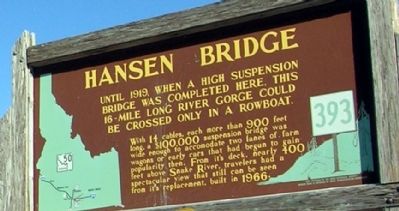
Hansen Bridge
Erected by Idaho Transportation Department and Idaho Historical Society. (Marker Number 393.)
Topics and series. This historical marker is listed in this topic list: Bridges & Viaducts. In addition, it is included in the Idaho State Historical Society series list. A significant historical year for this entry is 1919.
Location. 42° 33.94′ N, 114° 18.04′ W. Marker is near Hansen, Idaho, in Twin Falls County. Marker can be reached from State Highway 50, 0.3 miles north of County Road E3900N, on the left when traveling north. Touch for map. Marker is in this post office area: Hansen ID 83334, United States of America. Touch for directions.
Other nearby markers. At least 8 other markers are within 4 miles of this marker, measured as the crow flies. Ancient Lake Bonneville (within shouting distance of this marker); The Desert Bloomed (within shouting distance of this marker); Rock Creek Station (approx. 2.2 miles away); Hansen (approx. 2.3 miles away); First Trading Post (approx. 2.3 miles away); Snake River Canyon Gold Rush (approx. 3.3 miles away); Before there were potatoes, there was GOLD (approx. 3.3 miles away); History Through the Eyes of a Camera (approx. 3.3 miles away). Touch for a list and map of all markers in Hansen.
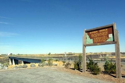
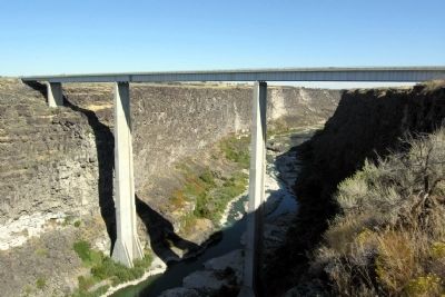
More about this marker. Marker and bridge may be viewed at the Hansen Overlook at the southwest end of the bridge.
Credits. This page was last revised on June 16, 2016. It was originally submitted on December 25, 2012, by Duane Hall of Abilene, Texas. This page has been viewed 646 times since then and 32 times this year. Photos: 1, 2, 3. submitted on December 25, 2012, by Duane Hall of Abilene, Texas. • Bill Pfingsten was the editor who published this page.


