Near Baldwyn in Lee County, Mississippi — The American South (East South Central)
Brice's Cross Roads
June 10, 1864
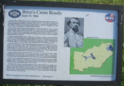
Still, Forrest's command worried Union planners. His cavalry could move fast, and when dismounted, strike hard. Sherman maintained only a single railroad line to supply depots in central Tennessee. Preservation of that rail link was essential if the push toward Atlanta was to continue. That "lifeline" was particularly vulnerable to attack from the southwest - Forrest's theater of operations. These larger considerations brought about the battle at Brice's Cross Roads that took place on June 10, 1864.
Forrest had actually begun to move on Sherman's lines on June 1, 1864, the same day that Brig. Gen. Samuel D. Sturgis left Memphis to engage Forrest's attention in Mississippi and Tennessee in order to keep him from mounting an attack on Sherman's supply line. Sturgis left Memphis with 8,100 troops - Forrest was ordered back to Mississippi to meet the Union invasion. After eight days of marching, Sturgis met Forrest's 3,500 cavalry in the dense brush east of Tishomingo Creek.
In the mire and muck of the rain-soaked Mississippi roads, Sturgis has allowed his command to string out for more than six miles. After a brief initial skirmish, Forrest engaged the advance Union cavalry units about noon with a superior force of dismounted cavalry, pushing the northerners back to a second line of battle hastily mounted by arriving infantry. The Union cavalry retired as infantry units were thrown into line as they reached the front - weary from the double-time march along impassable roads and exhausted by the heat of the day. Forrest launched another attack about 2:00 p.m. against the second Union line. Again outnumbered by Forrest's troops, the Yankees broke under several charges. It was only a concerted stand at the Cross Roads by Union artillery and a staunch defense by rear guard infantry at the Tishomingo Creek Bridge that allowed most of the Union troops to retreat west of the bridge.
Forrest's (now mounted) cavalry pressured the retreating Union force for more than 25 miles, resulting in heavy Union losses. Federal losses amounted to 223 killed, 394 wounded, and 1623 missing. Eighteen artillery pieces (of 20) and the entire train of 200 supply wagons were lost. Confederate losses amounted to 96 killed and 396 wounded.
In explaining his victory, Gen. Forrest is quoted as saying, "Well, I got there first with the most men." However, by late July, Atlanta had fallen, Grant laid siege to Petersburg and Richmond in October, and Forrest's command was again bottled up in northern Mississippi by Maj. Gen. Andrew J. Smith. When Forrest finally moved east into Alabama in November to join Maj. Gen. John Bell Hood's ill-fated invasion of central Tennessee, he had little effect on the major theaters of the larger war during 1864.
Inset Photo of Nathan Bedford Forrest
Map Location of Brice's Cross Roads Engagement relative to Grant and Sherman's Campaigns in Virginia and Georgia
Erected by CWPT (Civil War Preservation Trust). (Marker Number A-1.)
Topics. This historical marker is listed in this topic list: War, US Civil. A significant historical month for this entry is June 1945.
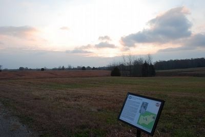
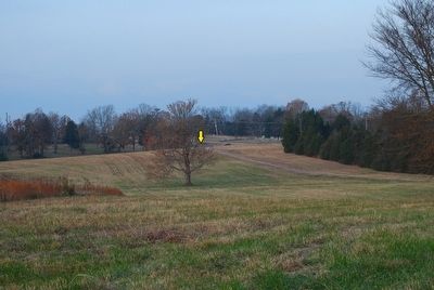
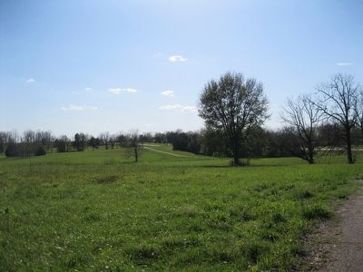
Location. 34° 30.396′ N, 88° 43.61′ W. Marker is near Baldwyn, Mississippi, in Lee County. Marker can be reached from Bethany Road (County Route 370) 0.1 miles east of Guntown/Ripley Road (County Route 370), on the left when traveling west. Interpretive tablet is 150 feet east of the beginning of a walking trail at Stop 5 of the Brice's Crossroads Auto Tour. The walking trail through Porter's Field parallels Bethany Road and is just under 2000 feet long. Touch for map. Marker is in this post office area: Baldwyn MS 38824, United States of America. Touch for directions.
Other nearby markers.
At least 8 other markers are within walking distance of this marker. Federal's Second Battle Line (within shouting distance of this marker); Battle of Brice's Cross Roads (about 600 feet away, measured in a direct line); a different marker also named Battle of Brices Cross Roads (about 600 feet away); General Sturgis' Supreme Effort (about 600 feet away); Brice Home (about 700 feet away); Bethany A.R.P. Church (about 800 feet away); Confederate's Second Battle Line (approx. 0.2 miles away); Morton's Battery (approx. 0.2 miles away). Touch for a list and map of all markers in Baldwyn.
Additional keywords. Brices Crossroads, Tishomingo
Credits. This page was last revised on June 16, 2016. It was originally submitted on December 27, 2012, by David Graff of Halifax, Nova Scotia. This page has been viewed 810 times since then and 20 times this year. Photos: 1. submitted on December 27, 2012, by David Graff of Halifax, Nova Scotia. 2, 3. submitted on September 25, 2015, by Brandon Fletcher of Chattanooga, Tennessee. 4. submitted on December 27, 2012, by David Graff of Halifax, Nova Scotia. • Craig Swain was the editor who published this page.


