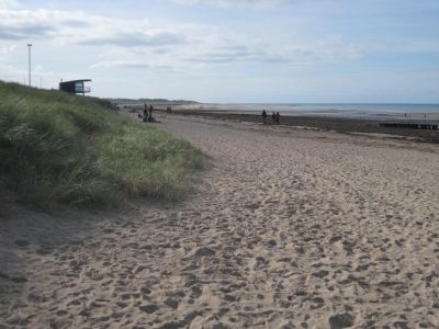
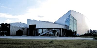
Courseulles-sur-Mer in Calvados, Normandy, France — Western Europe
Juno Beach
D-Day
— Jour-J —
Inscription.
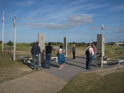
(This marker is composed of several pillars (vertical) with text inscribed upon them and several benches (horizontal) with photographs and illustration. Text is provided in both French and English.)
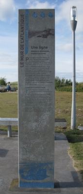
F Le Mur de L’Atlantique
The Atlantic Wall
(French)
Une ligne défensive allemande impressionnante
Pour protéger les territoires conquis par ses armées, Hitler lanca l’édification d’un Mur de Défense sur la côte Atlantique.
Des l’été 1941, l’organisation TODT (du nom de L’ingénieur responsable) mit en oeuvre ce project. Les fortifications majeures s’appuyaient sur de grands ports français et sur le Pas de Calais, où elles mettaient l’Europe continentale à 28 km de l’Angleterre, soit à portée de canons lourds. La Normandie était particuliérement equipée en raison de sa position stratégique.
De 1942 au printemps 1944, cette réalisation mobilsa 1 350 000 ouvriers dont 357 000 Allemands, 643 500 étrangers, 165 000 prisonners de guerre et 4 000 femmes. 10 400 000 tonnes de bèton furent coulées en 2 ans pour construire 9 671 TOBRUKS, 5 976 BUNKERS et 1591 autres ouvrages
(English)
An impressive German line of defence
To protect the territories conquered by his armies, Hitler ordered the construction of a defensive wall along the Atlantic seaboard.
The TODT organization (named after the engineer in charge) implemented the project in the summer of 1941. The main fortifications were based in the major French ports and in the Pas de Calais, were a mere 28 km separated continental Europe from the English coast, within the range of big guns. Normandy was heavily equipped due to its strategic position.
Between 1942 and the spring of 1944, the construction involved the mobilization of a workforce of 1,350,000 of whom 357,000 were German, alongside 643,500 foreigners, 165,000 prisoners of war and 4,000 women. Ten million four hundred thousand tonnes of concrete were mix in two years for the construction of 9,671 Tobruk pits, 5,976 bunkers and 1,591 other edifices.
The Bunkers
(French)
Des ouvrages défensifs, difficiles à attaquer
En 1944, la dune était plus étroite et les ouvrages défensifs, plus proches de la mer, pouvaient être battus par les vagues aux fortes marées. Ils étaient peu vulnérables aux bombs aériennes classiques de 500 kg de l’aviation alliée grace à l’épaisseur de leurs murs (2 à 3,50 métres). Les embrasures ne faisaient jamais face à la mer et les canons, positionnés parallèlement à la plage tous les 500 métres, croisaient leurs feux.
À Courseulles, les six bunkers abritaient des canons antichars, ceux-ci variaient du calibre 50 mm au redoutable 88 mm, installé à l’entrée du port (il était le canon antichar le plus performant au monde en 1943).
(English)
Defensive buildings difficult to attack
In 1944, the dune was narrower and the defensive structures, which were closer to the sea, could be reached by the waves at high spring tide.
Due to the thickness of their walls (2-3 metres), they were relatively invulnerable to the 500 kg bombs traditionally carried by Allied aircraft.
The openings never gave onto the sea and the fields of fire their guns, located every 500 metres along the beach, overlapped. The six bunkers in Courseulles housed anti-tank guns, varying in bore from 50-mm to the formidable 88-mm cannon positioned at the entrance of the port (the world’s most effective anti-tank weapon in 1943).
Le Jour-J heure par heure
A Bow by Blow Account of D-Day
Attaque alliée en force
A powerful Allied offensive
(Each entry is in French then English)
4-5 juin – 4th-5th June
Les voies de communications de l’ouest et les stations radars côtières allemandes sont déétruites. L’ennemi rendu aveugle, la Résistance reçoit l’ordre de sabotage et de lancement d’opérations de guerilla sur les arrières.
The lines of communication in the West and the German coastal radar stations were destroyed. The enemy was blinded; the
Resistance received the order to proceed with sabotage and guerrilla operations behind the lines.
6 juin – 6th June
00h05
Premiers parachutages américans sur le Cotentin, britanniques au nord est de Caen (6th Airborne).
The first American paratroops landed in the Cotentin, the British 6th Airborne to the north-east of Caen.
04h30
Bombardement aérien des batteries côtières.
Aerial bombardment of the coastal batteries.
05h30
Bombardement aérien des défenses des plages.
Aerial bombardment of the beach defences.
05h45
Bombardement naval des defénses côtières.
Naval bombardment of the coastal defences.
06h30
Débarquement de la 4e Division U.S. à Utah Beach.
Landing of the 4th US Division on Utah Beach.
06h45
Débarquement des 29e et 1e Division à Omaha Beach.
Landing of the 29th and 1st US Divisions on Omaha Beach.
07h30
Débarquement de la 50e Division Britannique à Gold Beach,
Landing of British 50th Division on Gold Beach.
07h35
Débarquement de la 3e Division Canadienne à Juno Beach.
Landing of 3rd Canadian Division on Juno Beach.
07h45
Débarquement de la 3e Division Brit. et 1er Special Services Brigade Brit. à Sword Beach.
Landing of British 3rd Division and British 1st Special Services Brigade on Sword Beach.
17h00
Atterrissage
des premiers renforts aeroportes.
Landing of the first airborne reinforcements.
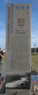
Le Débarquement Canadien
The Canadian Landing
(French)
Juno, tête de pont du Canada
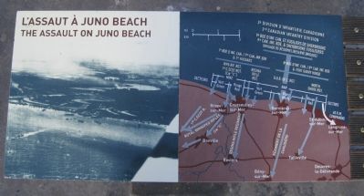
Le 6 juin 1944, sur une mer agitée, la 3e division d’infanterie (les “gars de la Victoire ou de la Mort”), et la 2e brigade blindée des Forces Armees du Canada abordent leur objectif: Juno. Ce nom de code désigne 8 kilometres de plage sur les communes de St-Aubin, Bernières, Courseulles et Graye-sur-Mer. Précédés par les parachutistes, transportés et soutenus par la marine de guerre, protégés depuis le ciel par les forces aériennes, 14 000 volontaires canadiens déferient. À la fin du jour, les troupes ont reussi à avancer assez profondément vers Creully, Colomby-sur-Thaon et Anisy, en deça des objectifs prévus mais assez loin pour considérer le débarquement comme un franc succés. Au cours des 80 jours de campagne en Normandie 5 500 militaires canadiens perdont la vie.
(English)
Juno, the Canadian bridgehead
On 6th June 1944, on a rough sea, the 3rd Infantry Division (“the Victory or Death boys”), and the 2nd Armoured Brigade of the Canadian Armed Forces reached their objective: Juno, this code-named designated 8 km of shoreline running past the villages of Saint-Aubin, Bernières, Courseulles and Graye-sur-Mer.
Preceded
by the paratroops, transported and supported by the navy, and with air force protection from above, 14,000 Canadian volunteers swept in over the beaches. By the end of the day, the troops had succeeded in advancing quite a long way inland toward Creully, Colomby-sur-Thaon and Anisy, falling short of their assigned objectives, but making sufficient inroads for the landing to be considered an unqualified success.
During the 80-day campaign in Normandy, 5,500 Canadian soldiers lost their lives.
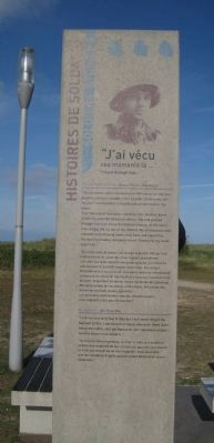
Histoires de Soldats
Soldiers’ Stories
“J’ai vecu ces monents la ...”
“l lived through that...”
Sapper Ralph Spencer – Regina Rifles – Nan Green
(English)
“My job was to place any GW charge on any gun position giving us trouble. I felt a bullet strike my left leg and I stumbled for a second and almost wait in the water.
This moment of hesitation cared my life. Another burst of MG fire took the forestock off my rifle and passed through the front of my battledress blouse, at the same time letting the air out of my lifebelt. My ammopouch was chewed up destroying some choc bars and cigarettes. The hand grenades remained intact: Thankfully my wade wasn’t hit!”
(French)
“Ma tâche était de placer une charge explosive GW sur tout emplacement de canon qui nous causait un problème. J’ai senti une
balle toucher ma jambe gauche, j’ai trébuché une second et j’ai failli tomber dans l’eau. Cet instant d’hesitation m’a sauvé la vie. Une autre rafale de mitrailleuse a emporté la crosse de mon fusil et a traversé l’avant de mon blouson, dégonflant en même temps a bouée de sauvetage. Ma cartouchière de munitions a été broyée, détruisant des barres de chocolat et des cigarettes.
Les grenades sont restées intactes. Heureusement, mes explosifs n’ont pas été touchés!”
R. Spencer – 6th Field Coy.
(English)
“I did not last long that D-Day but I will never forget my baptism of fire. I am sure that those who where there don’t need reminding; but perhaps post war Canadians maybe need to know more about it.”
(French)
“Je n’ai pas tenu longtemps, ce Jour-J, mais je n’oublierai jamais mon baptême de feu. Je suis sûr que ceux qui étaient là n’ont pas besoin qu’on leur rappelle; mais peut-être que les canadiens d’après-guerre auront besoin d’en savoir davantage.”
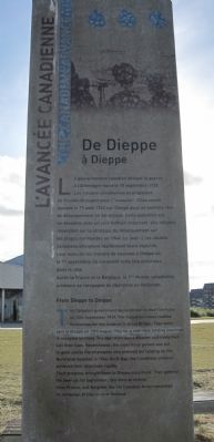
L’avancee canadienne
The Candadian Advance
(French)
De Dieppe a Dieppe
Le gouvernement canadien déclare le guerre a l’Allemagne nazie le 10 septembre 1939. Les troupes canadiennes se prèparent en Grande-Bretagne pour l’”invasion”. Elles seront lancées le 19 août 1942 sur Dieppe pour un exercice réel de débarquement en sol occupé. Cette opération est un désastre, avec un coût humain important, elle influera cependant sur la stratégie du débarquement sur les plaques normandes en 1944. Le Jour-J, les soldats canadiens atteignent rapidement leurs objectifs. Leurs avancée les mènera de nouveau à Dieppe où le 1er septembre, ils entreront cette fois victorieux dans la ville.
Après la France et la Belgique, la 1eme Armée canadienne achèvera sa campagne de libération en Hollande.
(English)
From Dieppe to Dieppe
The Canadian government declared war on Nazi Germany on 10th September 1939. The Canadian troops readied themselves for the invasion in Great Britain. They were sent to Dieppe on 19th August 1942 for a real-time landing exercise in occupied territory. The operation was a disaster and many men lost their lives. Nevertheless, the experience gained was put to good use by the strategists who planned the landings on the Normandy beaches in 1944. On D-Day, the Canadian soldiers achieved their objectives rapidly.
The progress brought them to Dieppe once more. The entered the town on 1st September, this time as victors.
After France and Belgium, the 1st Canadian Army completed its campaign of liberation in Holland.
Topics. This historical marker is listed in this topic list: War, World II. A significant historical date for this entry is September 10, 1939.
Location.
49° 20.216′ N, 0° 27.675′ W. Marker is in Courseulles-sur-Mer, Normandie (Normandy), in Calvados. Marker can be reached from Voie des Français Libres. This marker is found on the grounds of the Juno Beach Center. Touch for map. Marker is in this post office area: Courseulles-sur-Mer, Normandie 14470, France. Touch for directions.
Other nearby markers. At least 8 other markers are within 13 kilometers of this marker, measured as the crow flies. Royal Canadian Navy Memorial (a few steps from this marker); Fourth Light Anti-Aircraft Regiment (within shouting distance of this marker); In Memory of All Canadian Gunners (within shouting distance of this marker); Message to the French Resistance (within shouting distance of this marker); Arromanches-les-Bains : La Bataille d’Arromanches (approx. 11.4 kilometers away); Passerell de Route Flottante de Port Mulberry (approx. 11.5 kilometers away); Allan Beckett Memorial (approx. 11.5 kilometers away); Mulberry Harbours Memorial (approx. 11.6 kilometers away). Touch for a list and map of all markers in Courseulles-sur-Mer.
Also see . . .
1. Juno Beach - The Battle of Normandy -- D-Day-Overload.com. "Juno Beach is the second of the three invasion sectors of the Commonwealth forces. Here land the Canadians. The Juno beaches are located 1.5 kilometers east of Gold Beach and are located between the localities of La Rivière, in the West, and of Saint-Aubin-sur-Mer,
in the East, that is to say a total distance of nearly 8 kilometers." (Submitted on December 30, 2012, by Barry Swackhamer of Brentwood, California.)
2. Juno Beach - The Canadians on D-Day. "John Keegan, eminent British historian who wrote Six Armies in Normandy, stated the following concerning the Canadian 3rd Division on D-Day: “At the end of the day, its forward elements stood deeper into France than those of any other division. The opposition the Canadians faced was stronger than that of any other beach save Omaha. That was an accomplishment in which the whole nation could take considerable pride.”" (Submitted on December 30, 2012, by Barry Swackhamer of Brentwood, California.)
Additional keywords. Canada, D-Day, Jour-J
Photographed By Barry Swackhamer, September 30, 2012
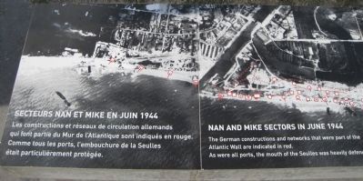
10. Nan and Mike Sectors in June 1944/Secteurs Nan et Mike en Juin 1944
(French)
Les constructions et réseaux de circulation allemands qui font partie du Mur du l’Atlantique son indiqués en rouge. Comme tous les ports, l’embouchure de la Seulles était particuliérement protégée.
(English)
The German constructions and networks that were part of the Atlantic Wall are indicated in red. As were all ports, the mouth of the Seulles was heavily defended.
(Click on image to enlarge.)
Credits. This page was last revised on February 3, 2024. It was originally submitted on December 30, 2012, by Barry Swackhamer of Brentwood, California. This page has been viewed 1,020 times since then and 32 times this year. Photos: 1, 2, 3, 4, 5, 6, 7, 8, 9, 10, 11, 12, 13, 14. submitted on December 30, 2012, by Barry Swackhamer of Brentwood, California. • Bill Pfingsten was the editor who published this page.
