Frankfort in Franklin County, Kentucky — The American South (East South Central)
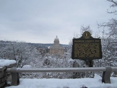
Franklin County, 1795

Photographed by Bernard Fisher, December 30, 2012
1. Franklin County, 1795 Marker
Erected 1970 by Kentucky Historical Society, Kentucky Department of Highways. (Marker Number 1359.)
Topics and series. This historical marker is listed in this topic list: Political Subdivisions. In addition, it is included in the Kentucky Historical Society series list. A significant historical year for this entry is 1792.
Location. 38° 11.223′ N, 84° 52.75′ W. Marker is in Frankfort, Kentucky, in Franklin County. It can be reached from Louisville Road (U.S. 60) 0.3 miles north of Lafayette Drive, on the right when traveling east. Located at the Capitol scenic overlook. Touch for map. Marker is in this post office area: Frankfort KY 40601, United States of America. Touch for directions.

Regionally, this marker is in Kentucky’s Bluegrass Region. It is also in the American South and specifically
this page online
Other nearby markers. At least 8 other markers are within walking distance of this marker: Welcome to Kentucky's Capitol and Capital (a few steps from this marker); Frankfort (within shouting distance of this marker); A Civil War Reprisal (approx. 0.2 miles away); Welcome To Kentucky (approx. 0.2 miles away); This Is Kentucky's Floral Clock (approx. 0.2 miles away); The Freedom Tree (approx. 0.2 miles away); The Frankfort Barracks (approx. 0.2 miles away); Emma Guy Cromwell (approx. 0.2 miles away). Touch for a list and map of all markers in Frankfort.
Photographed by Bernard Fisher, December 30, 2012
2. Capitol scenic overlook
Credits. This page was last revised on June 16, 2016. It was originally submitted on December 31, 2012, by Bernard Fisher of Richmond, Virginia. This page has been viewed 720 times since then and 23 times this year. Photos: 1, 2. submitted on December 31, 2012, by Bernard Fisher of Richmond, Virginia.
