Frankfort in Franklin County, Kentucky — The American South (East South Central)
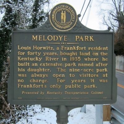
Melodye Park
Louis Horwitz, a Frankfort resident for forty years, bought land on the Kentucky River in 1935 where he built an extensive park named after his daughter. The nine-acre park was always open to visitors at no charge. For years it was Frankfort's only public park.
Presented by Kentucky Transportation Cabinet
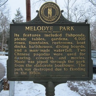
(side 2)
Its features included fishponds, picnic tables, gardens, 4,000 roses, fountains, restrooms, boat docks, bathhouses, diving boards, and a man-made waterfall. Two Chinese pagodas were used for dancing, concerts, and movies. Music was piped through the park from the elaborate boathouse. The park was destroyed due to flooding in the 1950s.
Erected 1999 by Kentucky Historical Society, Kentucky Department of Highways. (Marker Number 2031.)
Topics and series. This historical marker is listed in these topic lists: Charity & Public Work • Entertainment. In addition, it is included in the Kentucky Historical Society series list. A significant historical year for this entry is 1935.
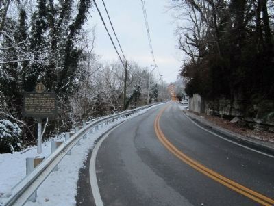
Location. 38° 11.346′ N, 84° 52.265′ W. Marker is in Frankfort, Kentucky, in Franklin County. Marker is at the intersection of Old Lawrenceburg Road (Kentucky Route 420) and East Todd Street, on the left when traveling south on Old Lawrenceburg Road. Touch for map. Marker is in this post office area: Frankfort KY 40601, United States of America. Touch for directions.
Other nearby markers. At least 8 other markers are within walking distance of this marker. New Capitol (approx. 0.2 miles away); Kentucky's Executive Mansion (approx. 0.2 miles away); Cherry Blossom Tree (approx. 0.2 miles away); Frankfort Chosen As Capital (approx. ¼ mile away); Gold Star Families Memorial Monument (approx. ¼ mile away); The Kentucky State Capitol Building (approx. ¼ mile away); Emma Guy Cromwell (approx. ¼ mile away); The Freedom Tree (approx. 0.3 miles away). Touch for a list and map of all markers in Frankfort.
More about this marker. This marker is located on an extremely dangerous blind curve. I would discourage motorist from pulling over to view it.
Credits. This page was last revised on June 16, 2016. It was originally submitted on December 31, 2012, by Bernard Fisher of Richmond, Virginia. This page has been viewed 673 times since then and 25 times this year. Photos: 1, 2, 3. submitted on December 31, 2012, by Bernard Fisher of Richmond, Virginia.


