Frankfort in Franklin County, Kentucky — The American South (East South Central)
The Frankfort Barracks
Photographed by Bernard Fisher, December 30, 2012
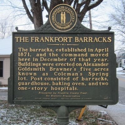
1. The Frankfort Barracks Marker
The barracks, established in April 1871, and the command moved here in December of that year. Buildings were erected on Alexander Goldsmith Brawner's five acres known as Coleman's Spring lot. Post consisted of barracks, guardhouse, baking oven, and two one-story hospitals.
Presented by Franklin County Trust for Historic Preservation
(side 2)
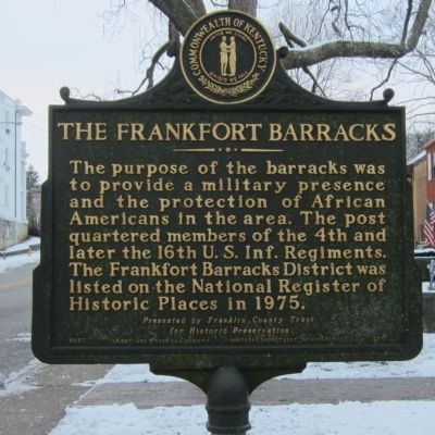
The purpose of the barracks was to provide a military presence and the protection of African Americans in the area. The post quartered members of the 4th and later the 16th U.S. Inf. Regiments. The Frankfort Barracks District was listed on the National Register of Historic Places in 1975.
Presented by Franklin County Trust for Historic Preservation
Erected 2001 by Kentucky Historical Society, Kentucky Department of Highways. (Marker Number 2061.)
Topics and series. This historical marker is listed in these topic lists: African Americans • Forts and Castles. In addition, it is included in the Kentucky Historical Society series list. A significant historical month for this entry is April 1871.
Location. 38° 11.349′ N, 84° 52.612′ W. Marker is in Frankfort, Kentucky, in
this page online

Regionally, this marker is in the Bluegrass Region. It is also in the American South and specifically in the Upper South. Globally, it is in North America, the Western Hemisphere, the Western World, and the Anglosphere. Historically, it finds itself in what was once the territory of the Mississippian Culture and also the Antebellum South.
Other nearby markers. At least 8 other markers are within walking distance of this marker: Emma Guy Cromwell (about 300 feet away, measured in a direct line); Frankfort Chosen As Capital (about 500 feet away); Gold Star Families Memorial Monument (about 500 feet away); The Freedom Tree (about 500 feet away); Frank Lloyd Wright / Rev. Jesse R. Zeigler House (about 500 feet away); New Capitol (about 600 feet away); Cherry Blossom Tree (about 700 feet away); The Kentucky State Capitol Building (approx. 0.2 miles away). Touch for a list and map
Photographed by Bernard Fisher, December 30, 2012
2. The Frankfort Barracks Marker
Photographed by Bernard Fisher, December 30, 2012
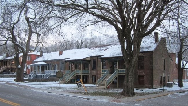
3. The Frankfort Barracks
Credits. This page was last revised on June 16, 2016. It was originally submitted on December 31, 2012, by Bernard Fisher of Richmond, Virginia. This page has been viewed 816 times since then and 33 times this year. Photos: 1, 2, 3. submitted on December 31, 2012, by Bernard Fisher of Richmond, Virginia.
