Frankfort in Franklin County, Kentucky — The American South (East South Central)
Fort Hill Overlooking the Kentucky River
Inscription.
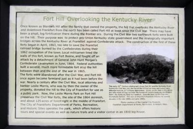
Once known as Blanton’s Hill after the family that owned the property, the hill that overlooks the Kentucky River and downtown Frankfort from the north has been called Fort Hill at least since the Civil War. There may have been a small, log fortification there during the frontier era. During the Civil War two earthwork forts were built on the hill. Their purpose was to protect pro-Union Kentucky state government and the strategically important bridges across the Kentucky River at Frankfort against Confederate attack. The construction of the first of these forts began in April, 1863, too late to save the Frankfort railroad bridge burned by the Confederates during their 1862 occupation of the town. Local militiamen lined the walls of this fort, known as Fort Boone, and fought off an attack by a detachment of General John Hunt Morgan’s Confederate cavalrymen in June, 1864. Federal authorities built a second, much more formidable fort atop the hill between then and the end of the war in 1865.
The forts were abandoned after the Civil War, and Fort Hill once again became farmland just as it had been before the war. Nearly a century after the Civil War, local attorney and banker Leslie Morris, who was by then the owner of the property, donated the hill to the City of Frankfort for use as a public park. Now, the Leslie Morris Park on Fort Hill preserves the Civil War forts, the site of the 1864 skirmish, and about 125 acres of forest right in the middle of Frankfort. The City of Frankforts Department of Parks, Recreation, and Historic Sites operates the park, which offers historic tours and special events as well as nature trails and a visitor center in an 1810 log house.
Topics. This historical marker is listed in these topic lists: Forts and Castles • War, US Civil. A significant historical month for this entry is April 1863.
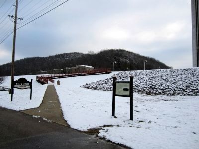
Location. 38° 12.25′ N, 84° 52.722′ W. Marker is in Frankfort, Kentucky, in Franklin County. Marker can be reached from Wilkinson Boulevard (U.S. 421) north of West Plaza Connector Road (U.S. 127), on the right when traveling south. Located along the Riverview Trail in Kentucky River View Park. Touch for map. Marker is at or near this postal address: 404 Wilkinson Blvd, Frankfort KY 40601, United States of America. Touch for directions.
Other nearby markers. At least 8 other markers are within walking distance of this marker. Gone But Not Forgotten – Frankfort’s “Craw” (within shouting distance of this marker); Kentucky River Water Trail (within shouting distance of this marker); List of CSO Points in Frankfort (within shouting distance of this marker); History of Kentucky's Formation (within shouting distance of this marker); Dry Stone Masonry in Kentucky (within shouting distance of this

2. Fort Hill Overlooking the Kentucky River
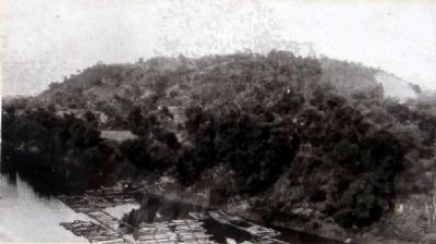
This early 20th Century photograph shows Fort Hill and the Kentucky River. During the Civil War era, the top of the hill had no trees and looked very different from its 21st Century appearance. Visible on the river in this photo are rafts made of logs cut from the forests of Eastern Kentucky and floated down the Kentucky River to Frankfort. Sawmills here cut the logs into marketable lumber. This was an important Frankfort industry for several decades in the late 1800s and early 1900s.
Photo courtesy of the Capital City Museum, Frankfort Department of Parks, Recreation, & Historic Sites.
Credits. This page was last revised on October 30, 2020. It was originally submitted on December 31, 2012, by Bernard Fisher of Richmond, Virginia. This page has been viewed 742 times since then and 27 times this year. Photos: 1, 2, 3. submitted on December 31, 2012, by Bernard Fisher of Richmond, Virginia.

