Belle Chasse in Plaquemines Parish, Louisiana — The American South (West South Central)
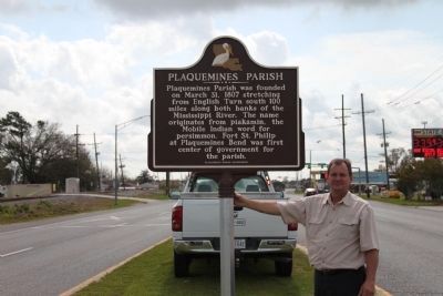
Plaquemines Parish
Erected 2012 by Plaquemines Parish Government.
Topics. This historical marker is listed in these topic lists: Settlements & Settlers • Waterways & Vessels. A significant historical month for this entry is March 1865.
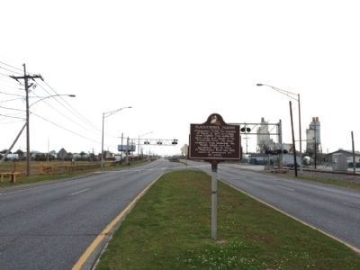
Location. 29° 52.585′ N, 90° 0.89′ W. Marker is in Belle Chasse, Louisiana, in Plaquemines Parish. Marker is on Belle Chasse Highway (State Highway 23) west of Mildred Street, in the median. Touch for map. Marker is at or near this postal address: 7124 Louisiana 23, Belle Chasse LA 70037, United States of America. Touch for directions.
Other nearby markers. At least 8 other markers are within 4 miles of this marker, measured as the crow flies. Jefferson Parish (approx. 0.8 miles away); Bellechasse Plantation (approx. 2.4 miles away); Mel Ott (approx. 2.6 miles away); Fort St. Leon (approx. 3 miles away); English Turn (approx. 3 miles away); Terrytown (approx. 3.4 miles away); City of Gretna (approx. 3.6 miles away); Saint Joseph Church (approx. 3.9 miles away). Touch for a list and map of all markers in Belle Chasse.
Credits. This page was last revised on June 16, 2016. It was originally submitted on January 4, 2013, by James D. Madere of Belle Chasse, Louisiana. This page has been viewed 1,287 times since then and 72 times this year. Photos: 1. submitted on January 4, 2013, by James D. Madere of Belle Chasse, Louisiana. 2, 3. submitted on February 25, 2015, by Mark Hilton of Montgomery, Alabama. • Bernard Fisher was the editor who published this page.


