Jefferson City in Cole County, Missouri — The American Midwest (Upper Plains)
Missouri Petroleum Marketers and Convenience Store Association
Photographed by William Fischer, Jr., January 22, 2012
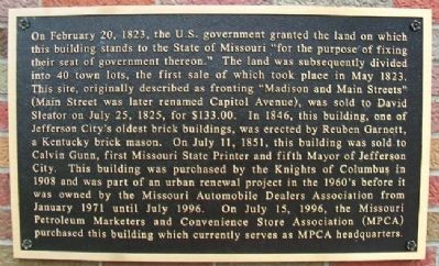
1. Missouri Petroleum Marketers and Convenience Store Association Marker
On February 20, 1823, the U.S. government granted the land on which this building stands to the State of Missouri "for the purpose of fixing their seat of government thereon." The land was subsequently divided into 40 town lots, the first sale of which took place in May 1823. This site, originally described as fronting "Madison and Main Streets" (Main Street was later renamed Capitol Avenue), was sold to David Sleator on July 25, 1825, for $133.00. In 1846, this building, one of Jefferson City's oldest brick buildings, was erected by Reuben Garnett, a Kentucky brick mason. On July 11, 1851, this building was sold to Calvin Gunn, first Missouri State Printer and fifth Mayor of Jefferson City. This building was purchased by the Knights of Columbus in 1908 and was part of an urban renewal project in the 1960's before it was owned by the Missouri Automobile Dealers Association from January 1971 until July 1996. On July 15, 1996, the Missouri Petroleum Marketers and Convenience Store Association (MPCA) purchased this building which currently serves as MPCA headquarters.
Topics. This historical marker is listed in these
this page online
Location. 38° 34.625′ N, 92° 10.185′ W. Marker is in Jefferson City, Missouri, in Cole County. It is at the intersection of Madison Street and Capitol Avenue, on the right when traveling north on Madison Street. Touch for map. Marker is at or near this postal address: 205 East Capitol Avenue, Jefferson City MO 65101, United States of America. Touch for directions.

Regionally, this marker is in the Missouri River Corridor. It is also in the American Midwest, in the Lewis & Clark Corridor, and in the Corn Belt. Globally, it is in North America, the Western Hemisphere, the Western World, and the Anglosphere. Historically, it finds itself in what was once the territory of the Mississippian Culture, the Louisiana Purchase, and the Antebellum South.
Other nearby markers. At least 8 other markers are within walking distance of this marker: Missouri Governor's Mansion (within shouting distance of this marker); Lewis and Clark Expedition (about 500 feet away, measured
Photographed by William Fischer, Jr., January 22, 2012
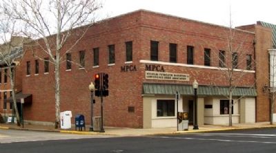
2. Missouri Petroleum Marketers and Convenience Store Association Building and Marker
Also see . . .
1. History/Heritage of Jefferson City, Missouri. City website entry (Submitted on January 5, 2013, by William Fischer, Jr. of Reynoldsburg, Ohio.)
2. Missouri Petroleum Marketers and Convenience Store Association. Association website homepage (Submitted on January 5, 2013, by William Fischer, Jr. of Reynoldsburg, Ohio.)
Credits. This page was last revised on January 17, 2025. It was originally submitted on January 5, 2013, by William Fischer, Jr. of Reynoldsburg, Ohio. This page has been viewed 588 times since then and 26 times this year. Photos: 1, 2. submitted on January 5, 2013, by William Fischer, Jr. of Reynoldsburg, Ohio.
