Salem in Essex County, Massachusetts — The American Northeast (New England)
Narbonne House
Salem Maritime National Historical Site
— National Park Service, U.S. Department of the Interior —
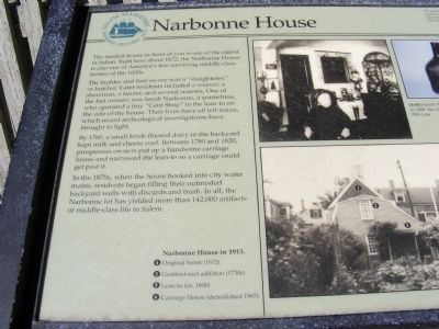
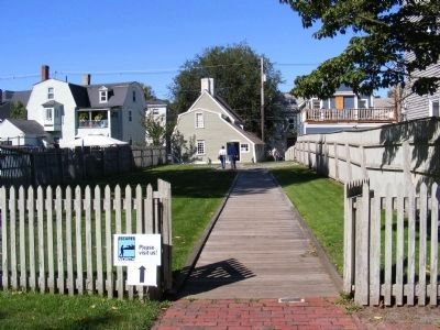
The modest house in front of you is one of the oldest in Salem. Built here in 1672, the Narbonne House is also one of America’s few surviving middle-class homes of the 1600s.
The builder and first owner was a”slaughterer,” or butcher, Later, residents included a weaver, a shoreman, a tanner, and several seamen. One of the last owners was Sarah Narbonne, a seamstress, who operated a tiny “Cent Shop” in the lean-to on the side of the house. Their lives have all left traces, which recent archeological investigations have brought to light.
By 1760, a small brick-floored dairy in the backyard kept milk and cheese cool. Between 1780 and 1820, prosperous owners put up a handsome carriage house and narrowed the lean-to so a carriage could get past it.
In the 1870s, when the house hooked into city water mains, residents began filling their outmoded backyard wells with discards and trash. In all, the Narbonne lot has yielded more than 142,000 artifacts of middle-class in Salem.
Narbonne House in 1913 (photo to the right): 1. Original home (1672). 2. Gambrel-roof addition (1730s). 3. Lean-to (ca. 1800). 4. Carriage House (demolished 1965).
Topics. This historical marker is listed in these topic lists: Architecture • Colonial Era • Settlements & Settlers. A significant historical year for this entry is 1672.
Location. This marker has been replaced by another marker nearby. It was located near 42° 31.349′ N, 70° 53.236′ W. Marker was in Salem, Massachusetts, in Essex County. Marker was on Essex Street. Touch for map. Marker was at or near this postal address: 71 Essex Street, Salem MA 01970, United States of America. Touch for directions.
Other nearby markers. At least 8 other markers are within walking distance of this location. A different marker also named Narbonne House (within shouting distance of this marker); Capt. John Hodges House - 1750 (within shouting distance of this marker); Custom House Place (within shouting distance of this marker); The Hawkes House (about 300 feet away, measured in a direct line); Derby House (about 300 feet away); Home for Aged Women (about 400 feet away); West India Goods Store (about 400 feet away); The Custom House (about 400 feet away). Touch for a list and map of all markers in Salem.
Related marker. Click here for another marker that is related to this marker. This marker has been replaced by the linked marker.

Photographed By Don Morfe, October 2, 2010
2. Narbonne House Marker
Right side of the marker.
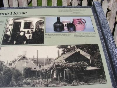
Narbonne House in 1913 (photo to the right): 1. Original home (1672). 2. Gambrel-roof addition (1730s). 3. Lean-to (ca. 1800). 4. Carriage House (demolished 1965).
(Top of the right side of the marker) The backbone of Maritime Massachusetts, however was its middle class; the captains and mates of vessels, the master builders and shipwrights, the rope-makers, and skilled mechanics of many trades, without whom the merchants were nothing.-Samuel Eliot Morison, Maritime History of Massachusetts 1921.
(Left Photo) Sarah Narbonne in her front room in 1888. She died two years later in her 95th year.
(Above photo) Discarded household goods included many everyday wares, as well as some high-quality ceramics.
Credits. This page was last revised on November 19, 2021. It was originally submitted on January 11, 2013, by Don Morfe of Baltimore, Maryland. This page has been viewed 557 times since then and 21 times this year. Photos: 1, 2, 3, 4. submitted on January 11, 2013, by Don Morfe of Baltimore, Maryland. • Bill Pfingsten was the editor who published this page.


