Harbor Islands- Long Island in Boston in Suffolk County, Massachusetts — The American Northeast (New England)
Coastal Mines
Fort Warren-Georges Island
| — | Boston Harbor Islands National Recreation Area | — |
Photographed by Don Morfe, October 3, 2010
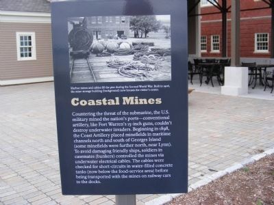
1. Coastal Mines Marker
This marker is outside of the fort near the food court.
Topics. This historical marker is listed in these topic lists: Forts and Castles • Military. A significant historical year for this entry is 1906.
Location. 42° 19.188′ N, 70° 55.8′ W. Marker is in Boston, Massachusetts, in Suffolk County. It is on Harbor Islands- Long Island. It is on Georges Island. Island is only accessible
this page online

Regionally, this marker is in Historic Boston and on the South Shore. It is also in the American Northeast, in New England, and on the Eastern Seaboard. Globally, it is in the North Atlantic Region, North America, the Western Hemisphere, the Western World, and the Anglosphere. Historically, it finds itself in what was once one of the original Thirteen Colonies.
Other nearby markers. At least 8 other markers are within walking distance of this marker: Confederate POWs (within shouting distance of this marker); Defense System (about 400 feet away, measured in a direct line); Escape! (about 500 feet away); Fort Warren (about 500 feet away); Powder Magazine (about 600 feet away); Parade Ground (about 800 feet away); Bakery (approx. 0.2 miles away); Political Prisoners (approx. 0.2 miles away). Touch for a list and map of all markers in Boston.
Photographed by Don Morfe, October 3, 2010
2. Coastal Mines Marker
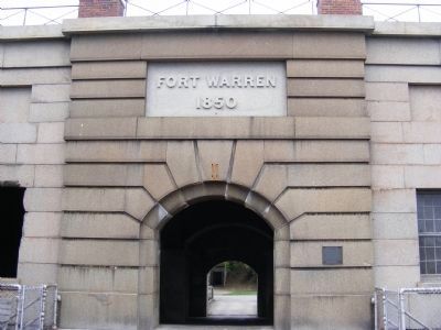
Fort Warren 1850-Entrance to the fort
Photographed by Don Morfe, October 3, 2010
3. Coastal Mines Marker
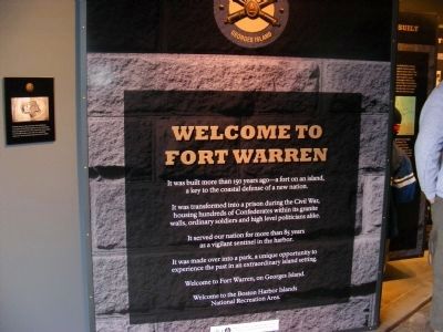
Welcome to Fort Warren-It was built more than 150 years ago-a fort on an island, a key to the coastal defense of a new nation.
It was transformed into a prison during the Civil War, housing hundreds of Confederates within its granite walls, ordinary soldiers and high level politicians alike. It served our nation for more than 85 year as a vigilant sentinel in the harbor. It made over into a park is an extraordinary island setting. Welcome to Fort Warren, on Georges Island. Welcome to the Boston Harbor Islands National Recreation Area.
Photographed by Don Morfe, October 3, 2010
4. Coastal Mines Marker
National Park Passport Cancellation Stamp-Ft Warren is part of the Boston Harbor Islands National Recreation Area.
Credits. This page was last revised on January 30, 2023. It was originally submitted on January 12, 2013, by Don Morfe of Baltimore, Maryland. This page has been viewed 595 times since then and 22 times this year. Photos: 1, 2, 3, 4. submitted on January 12, 2013, by Don Morfe of Baltimore, Maryland. • Bill Pfingsten was the editor who published this page.
