Cookeville in Putnam County, Tennessee — The American South (East South Central)
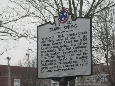
Town Spring
Erected by Tennessee Historical Commission. (Marker Number 2D 40.)
Topics and series. This historical marker is listed in this topic list: Natural Resources. In addition, it is included in the Tennessee Historical Commission series list. A significant historical month for this entry is July 1814.
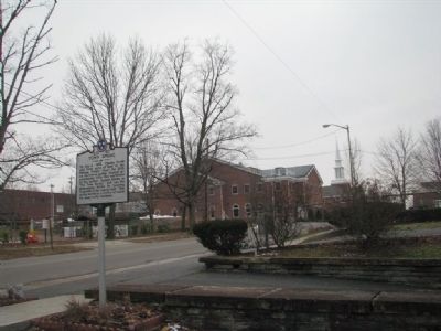
Location. 36° 9.84′ N, 85° 30.09′ W. Marker is in Cookeville, Tennessee, in Putnam County. Marker is at the intersection of N. Dixie Ave and Freeze St, on the right when traveling north on N. Dixie Ave. Touch for map. Marker is in this post office area: Cookeville TN 38501, United States of America. Touch for directions.
Other nearby markers. At least 8 other markers are within walking distance of this marker. Putnam County Courthouses (about 700 feet away, measured in a direct line); Veterans Statue (about 800 feet away); Putnam County Veterans Memorial (approx. 0.2 miles away); Putnam County's Third and Fourth Courthouses (approx. 0.2 miles away); Israel Putnam (approx. 0.2 miles away); Richard Fielding Cooke (approx. 0.2 miles away); Putnam County Revolutionary Memorial (approx. 0.2 miles away); Site of WHUB Radio's First Studios (approx. 0.2 miles away). Touch for a list and map of all markers in Cookeville.
Additional commentary.
1. End of the spring
“The spring continued to be used by local people even after they installed wells. In the 1960s, the spring was covered with asphalt to connect a road to the new Kuhn's Big K in Midtown Plaza.” —Images of America: Cookeville and Putnam County by Friends of the Cookeville History Museum
— Submitted July 16, 2014, by Deanna Lack of Sparta, Tennessee.
Credits. This page was last revised on June 16, 2016. It was originally submitted on February 13, 2010, by Tom Gillard of Tullahoma, Tennessee. This page has been viewed 1,201 times since then and 24 times this year. Last updated on January 14, 2013, by Byron Hooks of Sandy Springs, Georgia. Photos: 1, 2. submitted on February 13, 2010, by Tom Gillard of Tullahoma, Tennessee. • Bill Pfingsten was the editor who published this page.

