Near Sharpsburg in Washington County, Maryland — The American Northeast (Mid-Atlantic)
"With Flags Flying"
Union Major General John Sedgwick's division formed up in column of brigades: three brigades - each with more than 1,700 men - each brigade a double rank extending a half mile.
The lines moved toward the West Woods:
"With flags flying and the long unfaltering lines rising and falling as they crossed the rolling fields, it looked as if nothing could stop them."
A second observer saw a different picture:
"The total disregard of all ordinary military precaution in their swift and solitary advance was so manifest that it was observed and criticized as the devoted band moved on."
The lines crossed the Hagerstown Turnpike:
"Not an enemy appeared. The woods in front were as quiet as any sylvan shade could be."
Southern artillery officer Colonel Stephen D. Lee was worried. His commander, General Robert E. Lee, reassured him:
"'Don't be excited about it, Colonel, go tell General Hood to hold his ground. Reinforcements are now rapidly approaching between Sharpsburg and the ford. Tell him that I am coming to his support.' .... he called me and pointed to McLaws' division, then in sight, approaching at a double quick."
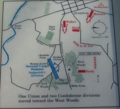
Confederate Brigadier General Jubal Early's brigade was west of the woods, and there were two Southern divisions approaching at a double quick. Major general Lafayette McLaws had marched his division through the night from Harpers Ferry, and Brigadier General John Walker's division had come up from south of town, where the Federals were still quiet.
Topics. This historical marker is listed in this topic list: War, US Civil.
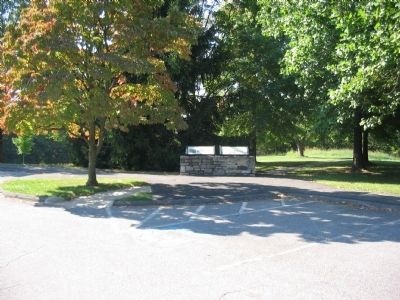
Location. This marker has been replaced by another marker nearby. 39° 28.697′ N, 77° 44.969′ W. Marker is near Sharpsburg, Maryland, in Washington County. Marker can be reached from Dunker Church Road / Old Hagerstown Pike, on the right when traveling south. Located at stop five of the driving tour of Antietam Battlefield, near the Philadelphia Brigade monument. Touch for map. Marker is in this post office area: Sharpsburg MD 21782, United States of America. Touch for directions.
Other nearby markers. At least 8 other markers are within walking distance of this location. The Onward Rush to Victory or Defeat (here, next to this marker); "Back Boys, For God's Sake Move Back;" (here, next to this marker); "The Jaws of Death" (here, next to this marker); Philadelphia Brigade Monument (within shouting distance of this marker); "We May Never Meet Again" (within shouting distance of this marker); Philadelphia Brigade Park (within shouting distance of this marker); The Baltimore Battery (within shouting distance of this marker); Brigadier General William E. Starke (within shouting distance of this marker). Touch for a list and map of all markers in Sharpsburg.
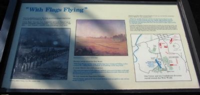
More about this marker. On the left is a sketch by Edwin Forbes, a Civil War combat artist showing a regiment in line of battle. In the center is a portion of a painting by Union Captain James Hope, illustrating the advance of Sedgwick's Division. On the right is a map detailing One Union and two Confederate divisions moved toward the West Woods.
Regarding "With Flags Flying". This marker was replaced by another named The Onward Rush to Victory or Defeat (see nearby markers).
Related markers. Click here for a list of markers that are related to this marker. Virtual tour of the West Woods by markers.
Also see . . . Antietam Battlefield. National Park Service site. (Submitted on March 16, 2008, by Craig Swain of Leesburg, Virginia.)

Photographed By Craig Swain, March 29, 2008
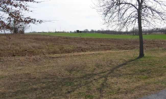
4. Sedgwick's Division Line of March
From Cornfield Avenue looking west. In the center distance is the dome of the Maryland Monument. To the right of that is Dunker Church (white building in the tree line). Sedgwick's Division advanced across the open fields here directly toward the West Woods, which extended from the location of the church, to the right side of the photo.
Credits. This page was last revised on September 21, 2017. It was originally submitted on March 16, 2008, by Craig Swain of Leesburg, Virginia. This page has been viewed 1,345 times since then and 15 times this year. Photos: 1. submitted on March 16, 2008, by Craig Swain of Leesburg, Virginia. 2. submitted on April 8, 2008, by Craig Swain of Leesburg, Virginia. 3. submitted on March 16, 2008, by Craig Swain of Leesburg, Virginia. 4. submitted on April 8, 2008, by Craig Swain of Leesburg, Virginia.


