Sewickley in Allegheny County, Pennsylvania — The American Northeast (Mid-Atlantic)
St. Matthews African Methodist Episcopal Zion Church
| — | Historic Landmark | — |
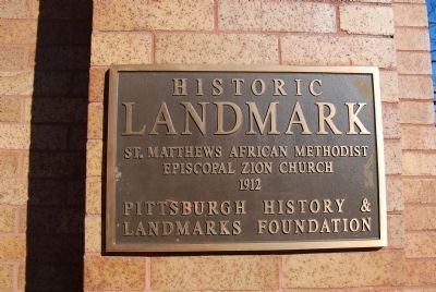
Photographed by Mike Wintermantel, January 19, 2013
1. Saint Matthews African Methodist Episcopal Zion Church Marker
1912
Erected by Pittsburgh History and Landmarks Foundation.
Topics and series. This historical marker is listed in this topic list: Religion & Religious Structures. In addition, it is included in the African Methodist Episcopal Zion (AME Zion) Church, and the Pennsylvania, Pittsburgh History and Landmarks Foundation series lists. A significant historical year for this entry is 1912.
Location. 40° 32.416′ N, 80° 10.974′ W. Marker is in Sewickley, Pennsylvania, in Allegheny County. It can be reached from the intersection of Thorn Street and Walnut Street, on the right when traveling west. Touch for map. Marker is in this post office area: Sewickley PA 15143, United States of America. Touch for directions.

Regionally, this marker is in Greater Pittsburgh. It is also in the American Northeast, in the Mid-Atlantic, in the Ohio River Valley, in Appalachia, and specifically in Northern Appalachia. Globally, it is in North America, the Western Hemisphere, the Western World, and the Anglosphere. Historically, it finds itself in what was once the Viceroyalty
this page online
Other nearby markers. At least 8 other markers are within walking distance of this marker: Atwell-Christy House (about 600 feet away, measured in a direct line); Sewickley Public Library (about 600 feet away); Sewickley Veterans Monument (about 600 feet away); Flatiron Building (approx. 0.2 miles away); Depreciation Lands Survey (approx. 0.2 miles away); Old Sewickley Post Office (approx. ¼ mile away); The Presbyterian Church (approx. ¼ mile away); Capt. Frederick Way, Jr. (approx. ¼ mile away). Touch for a list and map of all markers in Sewickley.
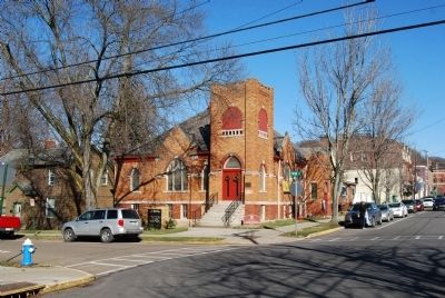
Photographed by Mike Wintermantel, January 19, 2013
2. Saint Matthews African Methodist Episcopal Zion Church Marker
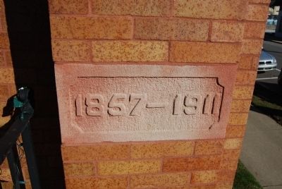
Photographed by Mike Wintermantel, January 19, 2013
3. Saint Matthews African Methodist Episcopal Zion Church Date Keystone
Credits. This page was last revised on July 25, 2026. It was originally submitted on January 19, 2013, by Mike Wintermantel of Pittsburgh, Pennsylvania. This page has been viewed 1,068 times since then and 74 times this year. Photos: 1, 2, 3. submitted on January 19, 2013, by Mike Wintermantel of Pittsburgh, Pennsylvania.
