San Juan Bautista in San Benito County, California — The American West (Pacific Coastal)
Jim Jack’s Cabin
Photographed by Barry Swackhamer, January 17, 2013
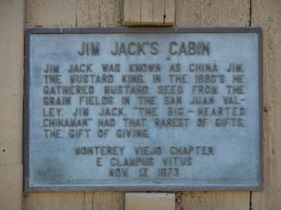
1. Jim Jack’s Cabin Marker
Erected 1973 by Monterey Viejo Chapter No. 1846, E Clampus Vitus.
Topics and series. This historical marker is listed in these topic lists: Asian Americans • Charity & Public Work • Settlements & Settlers. In addition, it is included in the E Clampus Vitus series list.
Location. 36° 50.843′ N, 121° 32.441′ W. Marker is in San Juan Bautista, California, in San Benito County. It can be reached from 3rd Street near Monterey Street, on the left when traveling south. Jim Jack's Cabin is located behind the San Juan Bautista Library. Touch for map. Marker is at or near this postal address: 800 3rd Street, San Juan Bautista CA 95045, United States of America. Touch for directions.

Regionally, this marker is on the Central Coast and specifically on the Coast Ranges. It is also on the American Pacific Coast. Globally, it is in North
this page online
Other nearby markers. At least 8 other markers are within walking distance of this marker: Carl M. Luck Gas Station (a few steps from this marker); Marentis House (about 600 feet away, measured in a direct line); Fremont Peak (approx. 0.2 miles away); Safety Follows Wisdom (approx. 0.2 miles away); Old School House (approx. 0.2 miles away); City of San Juan Bautista (approx. ¼ mile away); De Anza Expedition 1775 – 1776 (approx. ¼ mile away); Campo Santo (approx. ¼ mile away). Touch for a list and map of all markers in San Juan Bautista.
Photographed by Barry Swackhamer, January 17, 2013
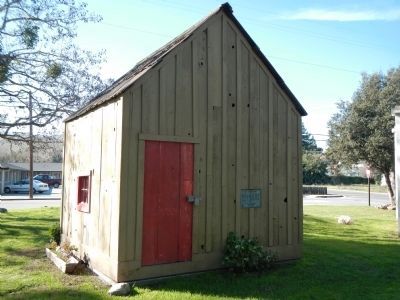
2. Jim Jack’s Cabin and Marker
Photographed by Barry Swackhamer, January 17, 2013
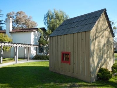
3. Jim Jack’s Cabin
Credits. This page was last revised on November 7, 2019. It was originally submitted on January 20, 2013, by Barry Swackhamer of Brentwood, California. This page has been viewed 924 times since then and 50 times this year. Photos: 1, 2, 3. submitted on January 20, 2013, by Barry Swackhamer of Brentwood, California. • Syd Whittle was the editor who published this page.
