Watsonville in Santa Cruz County, California — The American West (Pacific Coastal)
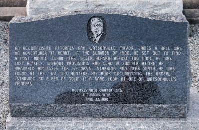
James A. Hall
Erected 1989 by Monterey Viejo Chapter No. 1846, E Clampus Vitus,.
Topics and series. This historical marker is listed in these topic lists: Arts, Letters, Music • Cemeteries & Burial Sites • Government & Politics • Industry & Commerce. In addition, it is included in the E Clampus Vitus series list. A significant historical year for this entry is 1900.
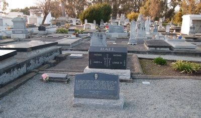
Location. 36° 56.491′ N, 121° 44.494′ W. Marker is in Watsonville, California, in Santa Cruz County. Marker can be reached from East Lake Avenue (California Route 152), on the right when traveling west. This marker is located at the Valley Catholic Cemetery, block 8. Touch for map. Marker is at or near this postal address: 2433 East Lake Avenue, Watsonville CA 95076, United States of America. Touch for directions.
Other nearby markers. At least 8 other markers are within 3 miles of this marker, measured as the crow flies. The Discovery of California Redwoods (approx. 1.4 miles away); Charley Darkey Parkhurst (approx. 1.7 miles away); Whiskey Hill (approx. 1.8 miles away); Men Die O Liberty That Thou Endurs (approx. 2 miles away); Lest We Forget (approx. 2.1 miles away); Judge Julius Lee House (approx. 2.2 miles away); St. Patricks Church (approx. 2.2 miles away); Watsonville (approx. 2.2 miles away). Touch for a list and map of all markers in Watsonville.
Credits. This page was last revised on November 8, 2019. It was originally submitted on January 24, 2013, by Barry Swackhamer of Brentwood, California. This page has been viewed 499 times since then and 14 times this year. Photos: 1, 2. submitted on January 24, 2013, by Barry Swackhamer of Brentwood, California. • Syd Whittle was the editor who published this page.

