Fourth Ward in Houston in Harris County, Texas — The American South (West South Central)
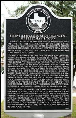
Twentieth Century Development of Freedman's Town
Inscription.
Founded on the south banks of Buffalo Bayou soon after the June 19, 1865 emancipation of enslaved blacks, Freedman's Town became the center of Houston's African American community. It originally stretched from Buffalo Bayou south to Sutton Street, and west from Milam and Travis streets to Taft Street.
During its heyday in the late 19th and early 20th centuries, Freedman's Town featured hundreds of houses, many of which were small "shotgun" frame dwellings, a common folk building type found along the Gulf Coast in Louisiana and Texas. Most often associated with African American neighborhoods, the shotgun form has been traced to black residents of Haiti, and through them to original homelands in Africa. The neighborhood also featured a number of larger homes built by community leaders, including the Rev. Jack Yates, his son Rutherford B. Yates, Alfred Smith, the Rev. Jeremiah Smith and the Rev. Ned P. Pullam. Churches and schools in Freedman's Town largely formed the basis for a strong and proud community identity. In addition, the neighborhood featured many businesses and institutions, including a high school, library, hospital and newspapers.
By the 1930s, Freedman's Town was the economic center for black Houston, the location of a high percentage of the city's black-owned businesses. From 1940 to the present, though, increased area development, including urban renewal programs and highway construction, has adversely affected Freedman's Town. Due to the perseverance of community residents, a large portion of the neighborhood was listed in the National Register of Historic Places in 1985.
Erected 2004 by Texas Historical Commission. (Marker Number 13318.)
Topics. This historical marker is listed in these topic lists: African Americans • Settlements & Settlers. A significant historical month for this entry is June 1882.
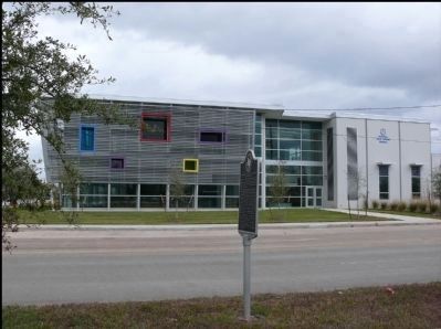
Location. 29° 45.203′ N, 95° 23.127′ W. Marker is in Houston, Texas, in Harris County. It is in the Fourth Ward. Marker is at the intersection of West Gray Street and Taft Street, on the right when traveling east on West Gray Street. Touch for map. Marker is in this post office area: Houston TX 77019, United States of America. Touch for directions.
Other nearby markers. At least 8 other markers are within walking distance of this marker. New Zion Temple Church - Worldwide Fellowship, Inc. (approx. 0.2 miles away); Gregory School (approx. ¼ mile away); Macedonia Missionary Baptist Church (approx. ¼ mile away); J. Vance Lewis (approx. 0.3 miles away); The Reverend Ned P. Pullum (approx. 0.3 miles away); St. James United Methodist Church (approx. 0.3 miles away); Rutherford B.H. Yates, Sr., House (approx. 0.3 miles away); DePelchin Faith Home (approx. 0.3 miles away). Touch for a list and map of all markers in Houston.
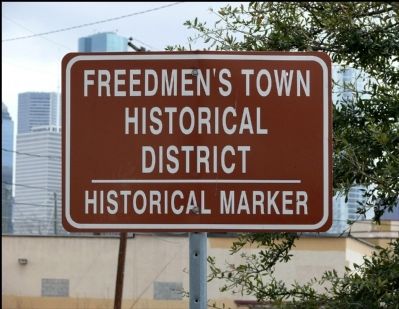
Regarding Twentieth Century Development of Freedman's Town. This marker does not refer to a person or structure, rather to an area of town
Related markers. Click here for a list of markers that are related to this marker. To better understand the relationship, study each marker in the order shown.
Also see . . .
1. Houston's Fourth Ward (Fredman's Town) in The Handbook of Texas. (Submitted on January 30, 2013, by Jim Evans of Houston, Texas.)
2. Houston's Fourth Ward (Fredman's Town) in Wikipedia. (Submitted on January 30, 2013, by Jim Evans of Houston, Texas.)
Credits. This page was last revised on February 1, 2023. It was originally submitted on January 30, 2013, by Jim Evans of Houston, Texas. This page has been viewed 716 times since then and 32 times this year. Photos: 1, 2, 3, 4. submitted on January 30, 2013, by Jim Evans of Houston, Texas. • Bill Pfingsten was the editor who published this page.


