Pajaro in Monterey County, California — The American West (Pacific Coastal)
The Portolá Expedition
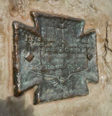
Photographed by Barry Swackhamer, January 29, 2013
1. Portola Expedition Marker
Erected 1905 by Women of Watsonville.
Topics and series. This historical marker is listed in this topic list: Exploration. In addition, it is included in the Portolá Expedition series list. A significant historical date for this entry is October 9, 1863.
Location. 36° 54.278′ N, 121° 45.022′ W. Marker is in Pajaro, California, in Monterey County. It is at the intersection of San Juan Road (County Road G11) and Porter Drive, on the left when traveling south on San Juan Road. Touch for map. Marker is at or near this postal address: 1 San Juan Road, Watsonville CA 95076, United States of America. Touch for directions.

Regionally, this marker is on the Central Coast and specifically on the Coast Ranges. It is also on the American Pacific Coast. Globally, it is in North America, on the Ring of Fire, in the Pacific Rim, in the Western Hemisphere, in the Western World, and in the Anglosphere. Historically, it finds itself in what was once New Spain and also Mexico’s Alta California.
Other nearby markers. At least
this page online
Also see . . . The Portolá Expedition of 1769. The following day they reached the Pajaro River, which they named for the large straw-stuffed bird (pajaro in Spanish) with a wingspan of over six feet in a deserted Indian village (the inhabitants fled after a visit from the scouts the previous day). (Submitted on February 11, 2013, by Barry Swackhamer of Brentwood, California.)
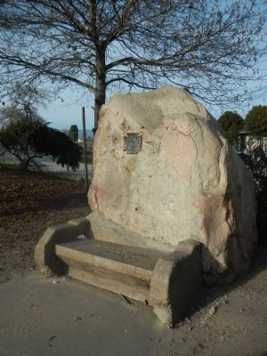
Photographed by Barry Swackhamer, January 29, 2013
2. Portola Expedition Marker
Credits. This page was last revised on June 16, 2016. It was originally submitted on February 11, 2013, by Barry Swackhamer of Brentwood, California. This page has been viewed 655 times since then and 21 times this year. Photos: 1, 2. submitted on February 11, 2013, by Barry Swackhamer of Brentwood, California. • Syd Whittle was the editor who published this page.
