Marker Logo HMdb.org THE HISTORICAL
MARKER DATABASE
“Bite-Size Bits of Local, National, and Global History”
Colusa in Colusa County, California — The American West (Pacific Coastal)
 

Center Section of the Former Colusa Bridge

Historical Landmark


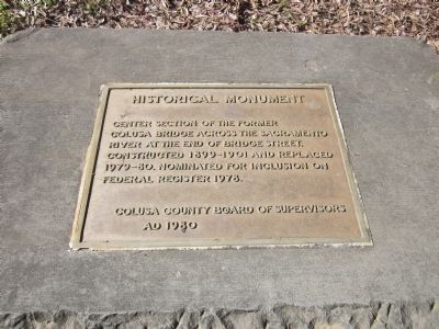
Center Section of the Former Colusa Bridge Marker image. Click for full size.
Photographed By Syd Whittle, February 10, 2013
1. Center Section of the Former Colusa Bridge Marker
Inscription.
Center section of the former Colusa Bridge across the Sacramento River at the end of Bridge Street. Constructed 1899-1901 and replaced 1979-80. Nominated for inclusion on Federal Register 1978.
 
Erected 1980 by Colusa County Board of Supervisors.
 
Topics. This historical marker is listed in this topic list: Bridges & Viaducts. A significant historical year for this entry is 1978.
 
Location. 39° 13.047′ N, 122° 0.859′ W. Marker is in Colusa, California, in Colusa County. Marker can be reached from Levee Street near 10th Street. Marker is near the entrance to the Sacramento River Recreation Area at Memorial Grove. Touch for map. Marker is in this post office area: Colusa CA 95932, United States of America. Touch for directions.
 
Other nearby markers. At least 8 other markers are within walking distance of this marker. Old Chinatown District--Circa 1890 (approx. 0.2 miles away); U. W. Brown House - Circa 1867 (approx. ¼ mile away); Adelade M. Ryerson House--1906 (approx. ¼ mile away); Judge H. M. Albery House (approx. 0.3 miles away); Will Semple Green House (approx. 0.3 miles away); Carnegie Library (approx. 0.4 miles away); Colusa County Courthouse (approx. 0.4 miles away); I.O.O.F. Building (approx. 0.4 miles away). Touch for a list and map of all markers in Colusa.
 
Paid Advertisement
Click on the ad for more information.
Please report objectionable advertising to the Editor.
Click or scan to see
this page online
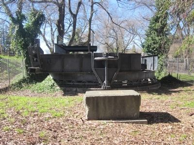
Center Section of the Former Colusa Bridge and Marker image. Click for full size.
Photographed By Syd Whittle, February 10, 2013
2. Center Section of the Former Colusa Bridge and Marker
The marker is mounted on the top of the concrete block in front of the bridge section.
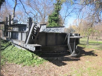
Center Section of the Former Colusa Bridge image. Click for full size.
Photographed By Syd Whittle, February 10, 2013
3. Center Section of the Former Colusa Bridge
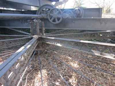
Mechanism and Gears image. Click for full size.
Photographed By Syd Whittle, February 10, 2013
4. Mechanism and Gears
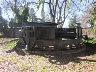
Bridge Section with Mechanism and Gears image. Click for full size.
Photographed By Syd Whittle, February 10, 2013
5. Bridge Section with Mechanism and Gears
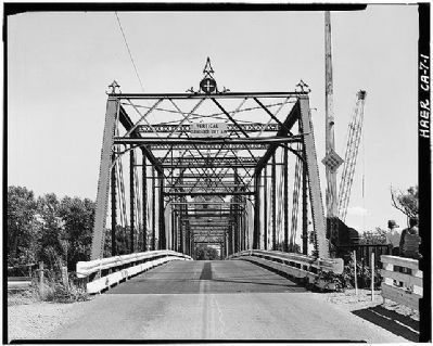
Colusa Bridge (Also Known as the Bridge Street Bridge) image. Click for full size.
Library of Congress - Prints and Photographs
6. Colusa Bridge (Also Known as the Bridge Street Bridge)
Standing approximately 50 feet south of the bridge, looking northerly along the bridge centerline.
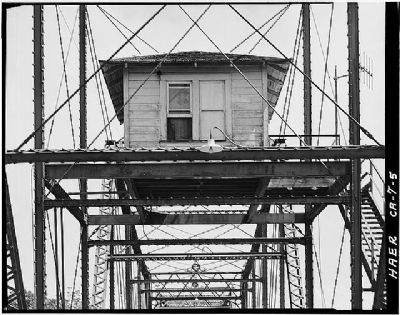
Control House image. Click for full size.
Library of Congress - Prints and Photographs
7. Control House
Standing at center line of bridge looking north at southside of the bridge control house.
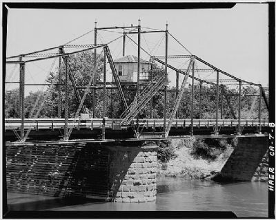
The Colusa Bridge image. Click for full size.
Library of Congress - Prints and Photographs
8. The Colusa Bridge
Standing on the south levee bank looking northwest showing most of the swing span portion of the bridge.
 
 
Credits. This page was last revised on April 7, 2023. It was originally submitted on February 18, 2013, by Syd Whittle of Mesa, Arizona. This page has been viewed 639 times since then and 27 times this year. Photos:   1, 2, 3, 4, 5, 6, 7, 8. submitted on February 19, 2013, by Syd Whittle of Mesa, Arizona.
Share this page.  
Share on Tumblr
m=63416

CeraNet Cloud Computing sponsors the Historical Marker Database.
This website earns income from purchases you make after using our links to Amazon.com. We appreciate your support.
Paid Advertisement
Apr. 19, 2024