Monterey in Monterey County, California — The American West (Pacific Coastal)
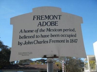
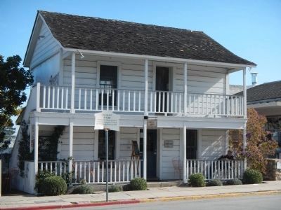
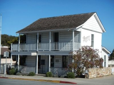
Fremont Adobe
Photographed by Barry Swackhamer, February 12, 2013
1. Fremont Adobe Marker
Erected by Monterey History & Art Association.
Topics. This historical marker is listed in these topic lists: Architecture • Notable Buildings. A significant historical year for this entry is 1847.
Location. 36° 35.761′ N, 121° 53.727′ W. Marker is in Monterey, California, in Monterey County. It is on Hartnell Street, on the left when traveling south. Touch for map. Marker is at or near this postal address: 550 Hartnell Street, Monterey CA 93940, United States of America. Touch for directions.

Regionally, this marker is on the Central Coast and specifically on the Coast Ranges. It is also on the American Pacific Coast. Globally, it is in North America, on the Ring of Fire, on the Pacific Rim, in the Western Hemisphere, in the Western World, and in the Anglosphere. Historically, it finds itself in what was once New Spain and also Mexico’s Alta California.
Other nearby markers. At least 8 other markers are within walking distance of this marker: Gabriel de la Torre Adobe (about 300 feet away, measured in a
this page online
Photographed by Barry Swackhamer, February 12, 2013
2. Fremont Adobe and Marker
Photographed by Barry Swackhamer, February 12, 2013
3. Fremont Adobe
Credits. This page was last revised on January 9, 2025. It was originally submitted on February 20, 2013, by Barry Swackhamer of Brentwood, California. This page has been viewed 796 times since then and 62 times this year. Photos: 1, 2, 3. submitted on February 20, 2013, by Barry Swackhamer of Brentwood, California. • Syd Whittle was the editor who published this page.
