Hermann in Gasconade County, Missouri — The American Midwest (Upper Plains)
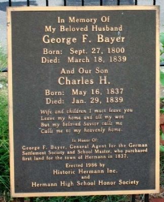
George F. Bayer
My Beloved Husband
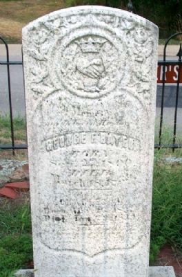
George F. Bayer
Born: Sept. 27, 1800
Died: March 18, 1839
And Our Son
Charles H.
Born: May 16, 1837
Died: Jan. 29, 1839
Wife and children I must leave you
Leave my home and all my woe
But my beloved Savior calls me
Calls me to my heavenly home.
In Honor Of:
George F. Bayer, General Agent for the German Settlement Society and School Master, who purchased first land for the town of Hermann in 1837.
Erected 1986 by Historic Hermann Inc. and Hermann High School Honor Society.
Topics. This historical marker is listed in this topic list: Settlements & Settlers. A significant historical month for this entry is March 1842.
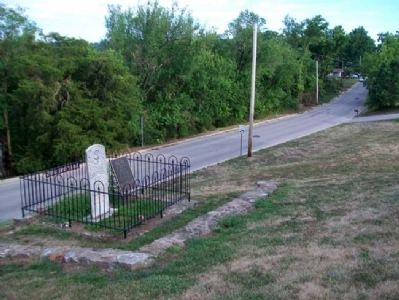
Location. 38° 41.934′ N, 91° 26.025′ W. Marker is in Hermann, Missouri, in Gasconade County. Marker is on Gutenberg Street south of 9th Street, on the right when traveling south. Marker is in Hermann Cemetery. Touch for map. Marker is in this post office area: Hermann MO 65041, United States of America. Touch for directions.
Other nearby markers. At least 8 other markers are within walking distance of this marker. "Big Hatchie" Steamboat Disaster (a few steps from this marker); The Weber-Schulte House (approx. 0.4 miles away); Bench Stones (approx. 0.4 miles away); a different marker also named George F. Bayer (approx. 0.4 miles away); German School (approx. 0.4 miles away); Drusch-Koeller Building (approx. 0.4 miles away); Dr. August Nasse - 1848 (approx. 0.4 miles away); Chrisman House (approx. 0.4 miles away). Touch for a list and map of all markers in Hermann.
Also see . . .
1. History of Hermann, Missouri. (Submitted on February 21, 2013, by William Fischer, Jr. of Scranton, Pennsylvania.)
2. The German settlement society of Philadelphia and its colony, Hermann, Missouri (1907). (Submitted on February 21, 2013, by William Fischer, Jr. of Scranton, Pennsylvania.)
Credits. This page was last revised on June 16, 2016. It was originally submitted on February 21, 2013, by William Fischer, Jr. of Scranton, Pennsylvania. This page has been viewed 498 times since then and 26 times this year. Photos: 1, 2, 3, 4. submitted on February 21, 2013, by William Fischer, Jr. of Scranton, Pennsylvania.


