Sharp-Leadenhall in Baltimore, Maryland — The American Northeast (Mid-Atlantic)
Leadenhall Baptist Church
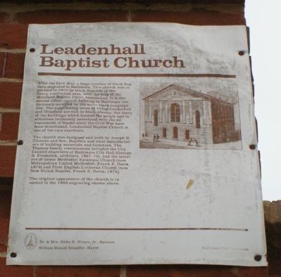
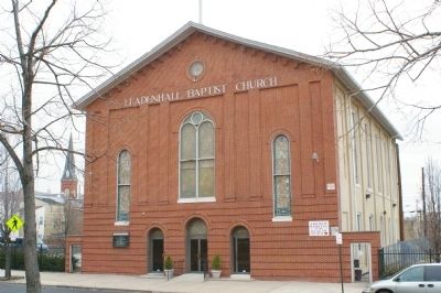
After the Civil War, a large number of black Baptists migrated to Baltimore. This church was organized in 1872 by black Baptists of the Sharp-Leadenhall area, with the help of the Maryland Baptist Union Association. It is the second oldest church building in Baltimore continuously occupied by the same black congregation. The neighboring areas of Sharp-Leadenhall and Otterbein are rich in black history, but many of the buildings which housed the people and institutions intimately assocated with the advancement of blacks since the Civil War have been demolished. Leadenhall Baptist Church is one of the rare survivors.
The church was designed and built by Joseph B. Thomas and Son, Baptists and local manufacturers of building materials and furniture. The Thomas family commissions included the City Council chambers of Baltimore City Hall (George A. Frederick, architect, 1867-75), and the interiors of Grace Methodist Episcopal Church (now Metropolitan United Methodist, Frank E. Davis, 1874) and First English Lutheran Church (now New Shiloh Baptist, Frank E. Davis, 1874).
The original appearance of the church is recorded in the 1885 engraving shown above.
Erected by the City of Baltimore, Dr. and Mrs. Eddie R. Wilson, Jr., sponsor, and William Donald Schaefer, mayor.
Topics and series. This historical marker is listed in these topic lists: African Americans • Churches & Religion. In addition, it is included in the Maryland, Baltimore City historical markers series list. A significant historical year for this entry is 1872.
Location. 39° 16.631′ N, 76° 37.057′ W. Marker is in Baltimore, Maryland. It is in Sharp-Leadenhall. Marker is at the intersection of Leadenhall Street and West Cross Street, on the right when traveling north on Leadenhall Street. Touch for map. Marker is at or near this postal address: 1021 Leadenhall St, Baltimore MD 21230, United States of America. Touch for directions.
Other nearby markers. At least 8 other markers are within walking distance of this marker. Struggling For Equality (about 400 feet away, measured in a direct line); Solo Gibbs Park (about 500 feet away); Gwynns Falls Trail (about 800 feet away); From Bricks and Pianos to Football (approx. 0.2 miles away); Ebenezer AME Church (approx. ¼ mile away); 8-10 Montgomery Street (approx. ¼ mile away); 9 East Montgomery Street (approx. ¼ mile away); Federal Hill and Otterbein (approx. ¼ mile away). Touch for a list and map of all markers in Baltimore.
Credits. This page was last revised on February 21, 2022. It was originally submitted on March 18, 2008, by Christopher Busta-Peck of Shaker Heights, Ohio. This page has been viewed 2,752 times since then and 14 times this year. Photos: 1, 2. submitted on March 18, 2008, by Christopher Busta-Peck of Shaker Heights, Ohio.

