Liberal in Barton County, Missouri — The American Midwest (Upper Plains)
Veterans Memorial
1776 • 1976
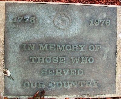
Photographed by William Fischer, Jr., March 7, 2013
1. Veterans Memorial Marker
Erected 1976.
Topics. This memorial is listed in this topic list: Military.
Location. 37° 33.899′ N, 94° 31.06′ W. Memorial is in Liberal, Missouri, in Barton County. It is at the intersection of NW 40th Road (Missouri Route K) and Denton, on the left when traveling east on NW 40th Road. Marker is in Liberal Memorial Park. Touch for map. Memorial is in this post office area: Liberal MO 64762, United States of America. Touch for directions.

Regionally, this memorial is in Southwest Missouri. It is also in the American Lewis & Clark Corridor and in the Corn Belt. Globally, it is in North America, the Western Hemisphere, the Western World, and the Anglosphere. Historically, it finds itself in what was once the territory of the Mississippian Culture, the Louisiana Purchase, and the Antebellum South.
Other nearby markers. At least 8 other markers are within 11 miles of this marker, measured as the crow flies: A different marker also named Veterans Memorial (approx. 5.7 miles away in Kansas); Arma Veterans Memorial (approx.
this page online
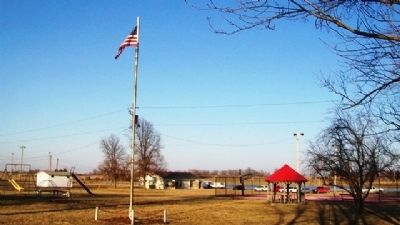
Photographed by William Fischer, Jr., March 7, 2013
2. Veterans Memorial Park
Credits. This page was last revised on December 10, 2020. It was originally submitted on March 7, 2013, by William Fischer, Jr. of Reynoldsburg, Ohio. This page has been viewed 584 times since then and 23 times this year. Photos: 1, 2. submitted on March 7, 2013, by William Fischer, Jr. of Reynoldsburg, Ohio.
