Titusville in Mercer County, New Jersey — The American Northeast (Mid-Atlantic)
Continental Lane
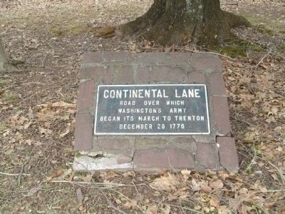
Photographed by John Ben Urban, March 2, 2013
1. Continental Lane Marker
Topics. This memorial is listed in this topic list: War, US Revolutionary.
Location. 40° 18.562′ N, 74° 50.942′ W. Memorial is in Titusville, New Jersey, in Mercer County. It is at the intersection of Bear Tavern Road (County Route 579 at milepost 5.4) and Washington Crossing Pennington Rd (County Route 546), on the right when traveling south on Bear Tavern Road. Located in the North West Corner of where Route 579 (Bear Tavern Road) and 546 (Washington Crossing Pennington Road) cross. Touch for map. Memorial is in this post office area: Titusville NJ 08560, United States of America. Touch for directions.

Regionally, this memorial is in Central Jersey and in Greater Princeton. It is also in the American Northeast and in the Mid-Atlantic. Globally, it is in North America, the Western Hemisphere, the Western World, and the Anglosphere. Historically, it finds itself in what was once New Netherland and also one of the original Thirteen Colonies.
Other nearby markers. At least 8 other
this page online
Related marker. Click here for another marker that is related to this marker.
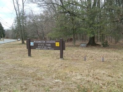
Photographed by John Ben Urban, March 2, 2013
2. Continental Lane Marker from a distance
Credits. This page was last revised on February 16, 2023. It was originally submitted on March 8, 2013, by John Ben Urban of Middletown, Delaware. This page has been viewed 876 times since then and 35 times this year. Photos: 1, 2. submitted on March 8, 2013, by John Ben Urban of Middletown, Delaware. • Bill Pfingsten was the editor who published this page.
