Woodway in McLennan County, Texas — The American South (West South Central)
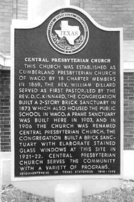
Central Presbyterian Church
Erected 1994 by Texas Historical Commission. (Marker Number 12537.)
Topics. This historical marker is listed in this topic list: Churches & Religion. A significant historical year for this entry is 1869.
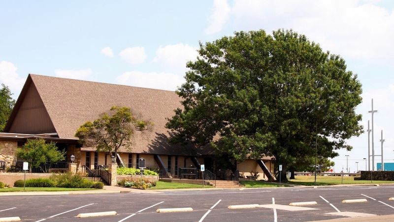
Location. 31° 29.797′ N, 97° 13.447′ W. Marker is in Woodway, Texas, in McLennan County. Marker is on Sharon Drive south of Bryce Drive, on the left when traveling south. Touch for map. Marker is at or near this postal address: 9191 Woodway Dr, Woodway TX 76712, United States of America. Touch for directions.
Other nearby markers. At least 8 other markers are within 5 miles of this marker, measured as the crow flies. Stanford Chapel Cemetery (approx. 1.9 miles away); First United Methodist Church of Waco (approx. 3.7 miles away); Waco Lodge No. 92, A.F. & A.M. (approx. 4 miles away); Congregation Rodef Sholom (approx. 4 miles away); Central Christian Church (approx. 4.4 miles away); Castle Heights (approx. 4˝ miles away); Congregation Agudath Jacob (approx. 4˝ miles away); Cobbs-Walker Cemetery (approx. 4.6 miles away).
More about this marker. Marker originally located at 1226 Washington Ave. in Waco and was relocated when congregation moved in 2004.
Also see . . . Central Presbyterian Church. (Submitted on March 14, 2013.)
Additional keywords. PCUSA
Credits. This page was last revised on September 8, 2019. It was originally submitted on March 13, 2013, by Karen Groman of Waco, Texas. This page has been viewed 613 times since then and 40 times this year. Photos: 1. submitted on March 13, 2013, by Karen Groman of Waco, Texas. 2. submitted on September 8, 2019, by Larry D. Moore of Del Valle, Texas. • Bernard Fisher was the editor who published this page.

