Corning in Nemaha County, Kansas — The American Midwest (Upper Plains)
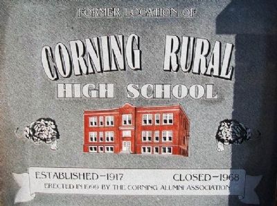
Former Location of Corning Rural High School
Established - 1917 • Closed - 1968
Inscription.
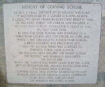
History of Corning School
In 1872 a small district schoolhouse was built. It was replaced by a larger building in 1878. A large, two-story frame building was built in 1893, on the land where the park is now located. A two-year high school graduated a class of five in that same year.
In 1905, the high school was changed to a three-year course and continued so until 1912, when it was changed to a four-year school. A brick building was erected in 1917, and the school name was changed to Corning Rural High School. The building also housed the grade school. The district was formally organized on Jan. 10, 1918.
In 1941, the school was rated Class "A" by the State Dept. of Education, the highest rating available for Kansas high schools. Corning Rural High School graduated its last class in 1968. Grade school classes continued to be held until January, 1983. The building was razed in 1990.
Erected 1999 by the Corning Alumni Association.
Topics. This historical marker is listed in this topic list: Education. A significant historical year for this entry is 1872.
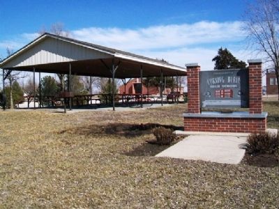
Location. 39° 39.306′ N, 96° 1.565′ W. Marker is in Corning, Kansas, in Nemaha County. Marker is on Atlantic south of 6th Street, on the right when traveling south. The marker is in the town park. Touch for map. Marker is in this post office area: Corning KS 66417, United States of America. Touch for directions.
Other nearby markers. At least 8 other markers are within 13 miles of this marker, measured as the crow flies. Asa Clark (within shouting distance of this marker); Goff Elementary & Goff Rural High School (approx. 5 miles away); Veteran's Memorial (approx. 8˝ miles away); a different marker also named Veterans Memorial (approx. 8˝ miles away); Original Town Well (approx. 8.9 miles away); Pony Express Home Station (approx. 12˝ miles away); The Smith Hotel (approx. 12˝ miles away); The Railroads (approx. 12˝ miles away).
Also see . . .
1. History of Nemaha County, Kansas (1916). (Submitted on March 18, 2013, by William Fischer, Jr. of Scranton, Pennsylvania.)
2. Corning, Kansas at Wikipedia. (Submitted on March 18, 2013, by William Fischer, Jr. of Scranton, Pennsylvania.)
Credits. This page was last revised on September 8, 2020. It was originally submitted on March 18, 2013, by William Fischer, Jr. of Scranton, Pennsylvania. This page has been viewed 554 times since then and 26 times this year. Photos: 1, 2, 3. submitted on March 18, 2013, by William Fischer, Jr. of Scranton, Pennsylvania.


