Soldier in Jackson County, Kansas — The American Midwest (Upper Plains)
Veteran's Memorial
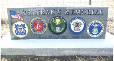
Photographed by William Fischer, Jr., March 11, 2013
1. Veteran's Memorial
Erected 2012 by Soldier Alumni Association.
Topics. This memorial is listed in this topic list: Military.
Location. 39° 32.491′ N, 95° 58.01′ W. Memorial is in Soldier, Kansas, in Jackson County. It is on State Highway 62 0.2 miles north of Friend Street, on the left when traveling north. Monument is in Soldier Cemetery. Touch for map. Memorial is in this post office area: Soldier KS 66540, United States of America. Touch for directions.

Regionally, this memorial is in Eastern Kansas. It is also in the American Midwest, in the Corn Belt, on the prairies, and on the Southern Plains. Globally, it is in North America, the Western Hemisphere, the Western World, and the Anglosphere. Historically, it finds itself in what was once the Louisiana Purchase.
Other nearby markers. At least 8 other markers are within 12 miles of this marker, measured as the crow flies: A different marker also named Veterans Memorial (about 600 feet away, measured in a direct line); Original Town Well (approx. 0.4 miles away); Former Location of Corning Rural High School
this page online
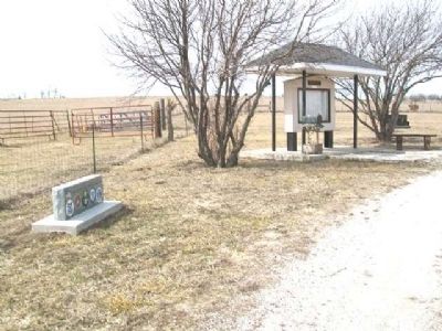
Photographed by William Fischer, Jr., March 11, 2013
2. Veteran's Memorial
Credits. This page was last revised on September 3, 2020. It was originally submitted on March 22, 2013, by William Fischer, Jr. of Reynoldsburg, Ohio. This page has been viewed 625 times since then and 24 times this year. Photos: 1, 2. submitted on March 22, 2013, by William Fischer, Jr. of Reynoldsburg, Ohio.
