Coalinga in Fresno County, California — The American West (Pacific Coastal)
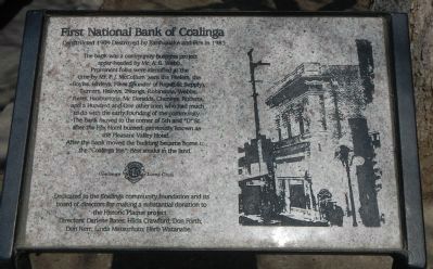
First National Bank of Coalinga
Constructed 1909 - Destroyed by Earthquake and Fire in 1983
Photographed by Barry Swackhamer, March 22, 2013
1. First National Bank of Coalinga Marker
After the bank moved the building became home to the “Coalinga Inn,” Best steaks in the land.
Dedicated to the Coalinga community foundation and its board of directors for making a substantial donation to the Historic Plaque project.
Directors: Darlene Bakes; Hilda Crawford; Don Forth; Don Kerr; Linda Matsumoto; Herb Watanabe.
Erected by Coalinga Lions Club.
Topics. This historical marker is listed in these topic lists: Industry & Commerce • Notable Buildings.
Location. 36° 8.418′ N, 120° 21.662′ W. Marker is in Coalinga,
this page online

Regionally, this marker is in the San Joaquin Valley, specifically in the Central Valley, and in the Sierra Nevada. It is also on the American Pacific Coast. Globally, it is in North America, on the Ring of Fire, on the Pacific Rim, in the Western Hemisphere, in the Western World, and in the Anglosphere. Historically, it finds itself in what was once New Spain and also Mexico’s Alta California.
Other nearby markers. At least 8 other markers are within walking distance of this marker: The Rockwell Building (within shouting distance of this marker); Row of Store Buildings Destroyed By Earthquake in 1983 (within shouting distance of this marker); 5th Street, Coalinga 1912 (within shouting distance of this marker); Pleasant Valley Hotel (within shouting distance of this marker); Webb Building (within shouting distance of this marker);
Photographed by Barry Swackhamer, March 22, 2013
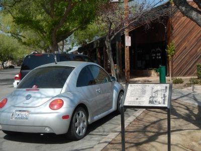
2. First National Bank of Coalinga Marker
Credits. This page was last revised on June 16, 2016. It was originally submitted on March 25, 2013, by Barry Swackhamer of Brentwood, California. This page has been viewed 789 times since then and 32 times this year. Photos: 1, 2. submitted on March 25, 2013, by Barry Swackhamer of Brentwood, California. • Syd Whittle was the editor who published this page.
