Coalinga in Fresno County, California — The American West (Pacific Coastal)
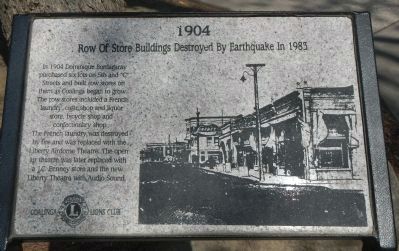
Row of Store Buildings Destroyed By Earthquake in 1983
1904
Inscription.
In 1909 Dominique Bordagaray purchased six lots on 5th and “C” Streets and built row stores on them as Coalinga began to grow. The row stores included a French laundry, cigar shop, and liquor store, bicycle shop and confectionery shop.
The French laundry was destroyed by fire and was replaced with the Liberty Airdome Theatre. The open air theatre was later replaced with a J.C. Penney store and new Liberty Theatre with Audio Sound.
Erected by Coalinga Lions Club.
Topics. This historical marker is listed in these topic lists: Disasters • Industry & Commerce • Notable Buildings. A significant historical year for this entry is 1909.
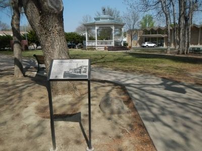
Location. 36° 8.433′ N, 120° 21.685′ W. Marker is in Coalinga, California, in Fresno County. Marker is on Coalinga Plaza (North 5th Street) near East Durian Avenue, on the right when traveling north. This marker is located in Frame Park. Touch for map. Marker is at or near this postal address: 300 Coalinga Plaza, Coalinga CA 93210, United States of America. Touch for directions.
Other nearby markers. At least 8 other markers are within walking distance of this marker. The Rockwell Building (within shouting distance of this marker); Pleasant Valley Hotel (within shouting distance of this marker); First National Bank of Coalinga (within shouting distance of this marker); 5th Street, Coalinga 1912 (about 300 feet away, measured in a direct line); The Bertrich Block (about 300 feet away); Liberty “Airdome Theater” (about 300 feet away); Webb Building (about 400 feet away); Coalinga Woman’s Club (about 400 feet away). Touch for a list and map of all markers in Coalinga.
Credits. This page was last revised on March 1, 2023. It was originally submitted on March 25, 2013, by Barry Swackhamer of Brentwood, California. This page has been viewed 698 times since then and 23 times this year. Photos: 1, 2, 3. submitted on March 25, 2013, by Barry Swackhamer of Brentwood, California. • Syd Whittle was the editor who published this page.


