Northeast Kansas City in Jackson County, Missouri — The American Midwest (Upper Plains)
Gladstone Boulevard Bridge over Anderson Avenue
Photographed by William Fischer, Jr., February 15, 2013
1. Gladstone Boulevard Bridge Marker
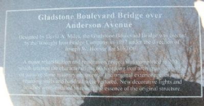
Designed by David A. Miles, the Gladstone Boulevard Bridge was erected by the Wrought Iron Bridge Company in 1897 under the direction of Joseph W. Hoover for $16,000.
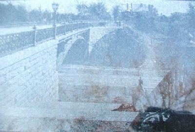
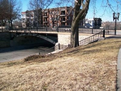
A major rehabilitation and restoration project was completed in 2003, which retrained the character of the 60-foot long iron arch span supported on massive stone masonry abutments. The original exterior arches, stairs, retaining walls and handrail were restored. New decorative lights and benches were installed to reflect the essence of the original structure.
Erected by Kansas City Missouri Board of Parks and Recreation Commissioners.
Topics. This historical marker is listed in this topic list: Bridges & Viaducts. A significant historical year for this entry is 1897.
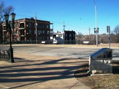
Location. 39° 6.708′ N, 94° 32.738′ W. Marker is in Kansas City, Missouri, in Jackson County. It is in Northeast Kansas City. It is at the intersection of Gladstone Boulevard and Anderson Avenue, on the right when traveling north on Gladstone Boulevard. Touch for map. Marker is in this post office area: Kansas City MO 64124, United States of America. Touch for directions.

Regionally, this
this page online
Other nearby markers. At least 8 other markers are within 2 miles of this marker, measured as the crow flies: Founders of Children's Mercy Hospital (a few steps from this marker); Scarritt Point (approx. 0.4 miles away); Scarritt Point Neighborhood (approx. 0.4 miles away); Independence Boulevard (approx. 0.4 miles away); a different marker also named Independence Boulevard (approx. half a mile away); Garrison Field House (approx. 1.2 miles away); The Rebirth of Twelfth and Vine (approx. 1.2 miles away); Goin' to Kansas City Plaza (approx. 1.3 miles away). Touch for a list and map of all markers in Kansas City.
Also see . . . Anderson Avenue at Gladstone Boulevard. Kansas City Public Library website entry (Submitted on June 19, 2024, by Larry Gertner of New York, New York.)
Photographed by William Fischer, Jr., February 15, 2013
2. Gladstone Boulevard Bridge Marker
3. Image on Marker
Photographed by William Fischer, Jr.
4. Gladstone Boulevard Bridge over Anderson Avenue
Credits. This page was last revised on August 23, 2026. It was originally submitted on March 25, 2013, by William Fischer, Jr. of Reynoldsburg, Ohio. This page has been viewed 757 times since then and 39 times this year. Photos: 1, 2, 3, 4. submitted on March 25, 2013, by William Fischer, Jr. of Reynoldsburg, Ohio.
