Jerusalem, Jerusalem District, Israel — The Middle East (West Asia)
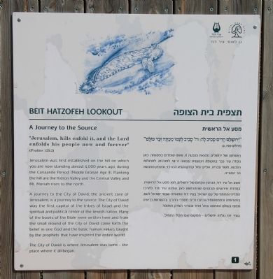
Beit Hatzofeh Lookout
A Journey to the Source
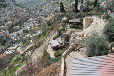
Jerusalem was first established on the hill on which you are now standing almost 4,000 years ago, during the Canaanite Period (Middle Bronze Age II). Flanking the hill are the Kidron Valley and the Central Valley and Mt. Moriah rises to the north.
A journey to the City of David, the ancient core of Jerusalem, is a journey to the source. The City of David was the first capital of the tribes of Israel and the spiritual and political center of the Jewish nation. Many of the books of the Bible were written here and from the small mound of the City of David came forth the belief in one God and the basic human values taught by the prophets that have inspired the entire world.
The City of David is where Jerusalem was born - the place where it all began.
Topics and series. This historical marker is listed in this topic list: Settlements & Settlers. In addition, it is included in the City of David Tour series list.
Location. 31° 46.454′ N, 35° 14.161′ E. Marker is in Jerusalem, Jerusalem District. Marker can be reached from Ma'alot Ir David Street just east of Ma'ale HaShalom, on the left when traveling south. This historical marker is located just off of the roadway, inside the "City of David - Ancient Jerusalem" facility, which offers visitors a tour of both historic and archaeological sites that are part of the Ancient City of David. It is situated at Stop One of the City of David historic tour route, which is on a roof top observation platform. Touch for map. Touch for directions.
Other nearby markers. At least 8 other markers are within walking distance of this marker. The Royal Quarter (Area G) (within shouting distance of this marker); The Large Stone Structure (within shouting distance of this marker); The Burnt Room and the House of the Bullae (within shouting distance of this marker); The House of Ahiel (within shouting distance of this marker); The Ophel Mikveh Trail (about 90 meters away, measured in a direct line in Israel); Two superposed vaulted rooms (about 90 meters away in Israel); The Gate House (about 90 meters away in Israel); A Stepped Ritual Bath (about 90 meters away in Israel). Touch for a list and map of all markers in Jerusalem.
Regarding Beit Hatzofeh Lookout. The "City of David - Ancient Jerusalem" handout/brochure has this to say about the Beit Hatzofeh stop on the historic tour:
"From this vantage point you can see the mountains that surround the City of David on all sides. This is the view that inspired the words of the Psalmist: 'Jerusalem, hills enfold it, and the Lord enfolds His people...'"
"Although
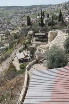
the hill of the City of David is relatively low, in antiquity it towered over the deep valleys that surrounded it on almost every side. The eastern slope that descends to the Kidron Valley is still very steep, though much less so than in the past due to the accumulation of rubble and debris. Across the valley, on the Mt of Olives, tombs from the city's First Temple period cemetery can be seen, above them to the north are the myriads of tombstones from the hallowed Jewish cemetery."
"Looking north you can see the Temple Mount or Mount Moriah, the traditional site of the Binding of Isaac. David's son Solomon enlarged the city to include Mount Moriah, where he built the Temple (2 Chronicles 3: 1). In the Ophel area between the City of David and the Temple he built his royal palace. A wall connected the city to the new royal quarter, merging the two areas into one. 'Jerusalem built up, a city knit together.' (Psalms 122: 3)."
"In the eighth century BCE, the city expanded to the Western Hill, where Mount Zion and the Jewish and Armenian quarters stand today. The Mishneh (2 Chronicles 34: 22) and other neighborhoods built on the Western Hill contributed to the growth of the city, and by the end of the First Temple period, Jerusalem covered an area of approximately 700 dunams (about 177 acres) - a very large city for those days."
Related markers.
Photographed By Dale K. Benington, March 12, 2013
3. Beit Hatzofeh Lookout Site
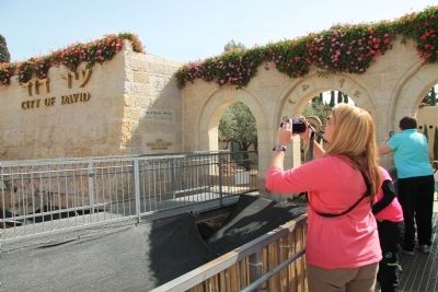
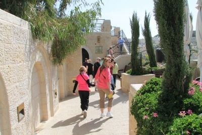
View of visitors to the City of David Archaeological Park, on the park's tour route, approaching the stairs that will take them to the rooftop observation platform, where the Beit Hatzofeh Lookout historical marker is located.
Also see . . .
1. City of David. This is a link to information provided by the "City of David - Ancient Jerusalem" website. (Submitted on March 26, 2013, by Dale K. Benington of Toledo, Ohio.)
2. Traveling adventures: City Of David. This is a link to information provided by a blog entitled Traveling Adventures. (Submitted on March 26, 2013, by Dale K. Benington of Toledo, Ohio.)
3. City of David. This is a link to information provided by a website entitled Jerusalem 101. (Submitted on March 27, 2013, by Dale K. Benington of Toledo, Ohio.)
Photographed By Dale K. Benington, March 12, 2013
4. Beit Hatzofeh Lookout Marker
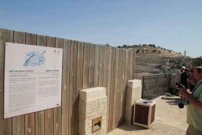
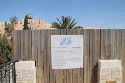
View of the historical marker affixed to a rooftop privacy fence, with a view to the north of the Old City of Jerusalem and the dome of the Al-Aqsa Mosque (where the Temple Mount is located) in the background of the picture.
Credits. This page was last revised on July 24, 2018. It was originally submitted on March 25, 2013, by Dale K. Benington of Toledo, Ohio. This page has been viewed 2,214 times since then and 28 times this year. Photos: 1, 2, 3, 4, 5, 6, 7. submitted on March 26, 2013, by Dale K. Benington of Toledo, Ohio.
