Jerusalem, Jerusalem District, Israel — The Middle East (West Asia)
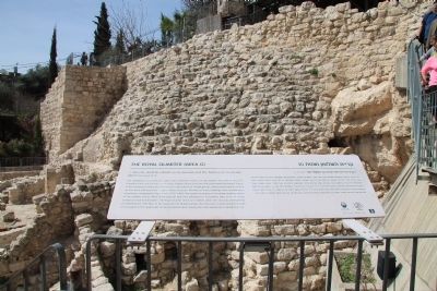
The Royal Quarter (Area G)
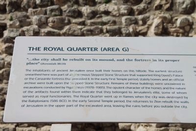
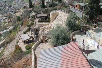
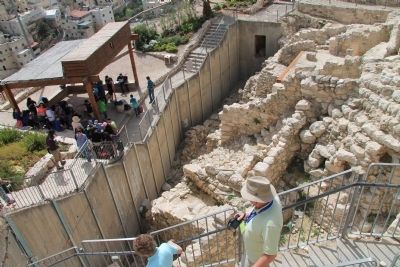
The inhabitants of ancient Jerusalem once built their homes on this hillside. The earliest structure unearthed here was part of an enormous Stepped Stone Structure that supported King David's Palace or the Canaanite fortress that preceded it. In the early First Temple period, stately homes and an official archive were built upon the Stepped Stone Structure. Remains of these buildings were uncovered in excavations conducted by Yigal Shiloh (1978-1985). The opulent character of the homes and the nature of the artifacts found within them indicate that they belonged to Jerusalem's elite, some of whom served as royal functionaries. The Royal Quarter went up in flames when the city was destroyed by the Babylonians (586 BCE). In the early Second Temple period, the returnees to Zion rebuilt the walls of Jerusalem in the upper part of the excavated area, leaving the ruins before you outside the city.
Topics and series. This historical marker is listed in these topic lists: Forts and Castles • Settlements & Settlers. In addition, it is included in the City of David Tour series list.
Location. 31° 46.435′ N, 35° 14.163′ E. Marker is in Jerusalem, Jerusalem District. Marker can be reached from Ma'alot Ir David Street just east of Ma'ale HaShalom, on the left when traveling south. This historical marker is located just off of the roadway, inside the "City of David - Ancient Jerusalem" facility, which offers visitors a tour of both historic and archaeological sites that are part of the Ancient City of David. It is situated at Stop Three of the City of David historic tour route, which is at the enormous Stepped Stone Structure that supported either King David's Palace or the Canaanite fortress that preceded it. Touch for map. Touch for directions.
Other nearby markers. At least 8 other markers are within walking distance of this marker. The Large Stone Structure (a few steps from this marker); The Burnt Room and the House of the Bullae (a few steps from this marker); The House of Ahiel (a few steps from this marker); Beit Hatzofeh Lookout (within shouting distance of this marker); The Water System (about 90 meters away, measured in a direct line); Two superposed vaulted rooms (about 120 meters away in Israel); The Ophel Mikveh Trail (about 120 meters away in Israel); The Gate House (about 120 meters away in Israel). Touch for a list and map of all markers in Jerusalem.
Regarding The Royal Quarter (Area G). The "City of David - Ancient Jerusalem" handout/brochure has this to say about the Royal Quarter (Area G) stop on the historic tour:
"Many of the homes
of ancient Jerusalem were built on this slope. The nature of these dwellings and the remains found within them show that during the First Temple period this was a residential quarter inhabited by notables and royal officials. The Royal Quarter was destroyed, together with the rest of Jerusalem, by the Babylonians in the year 586 BCE. In the first part of the Second Temple period, a new city wall was built at the top of the excavation area seen here, leaving the ruins before you outside the city limits."
Related markers. Click here for a list of markers that are related to this marker. To better understand the relationship, study each marker in the order shown.
Also see . . .
1. City of David. This is a link to information provided by the "City of David - Ancient Jerusalem" website. (Submitted on March 26, 2013, by Dale K. Benington of Toledo, Ohio.)
2. Jebusite Wall (Millo) (2000-1000 BC). This is a link to information provided by a website entitled Jerusalem 101. (Submitted on March 27, 2013, by Dale K. Benington of Toledo, Ohio.)
3. The City of David. This is a link to information provided by a website entitled Jerusalem 101. (Submitted on March 27, 2013, by Dale K. Benington of Toledo, Ohio.)
Credits. This page was last revised on April 19, 2022. It was originally submitted on March 26, 2013, by Dale K. Benington of Toledo, Ohio. This page has been viewed 1,529 times since then and 24 times this year. Photos: 1, 2, 3, 4. submitted on March 26, 2013, by Dale K. Benington of Toledo, Ohio.


