Turner in Marion County, Oregon — The American West (Northwest)
Turner
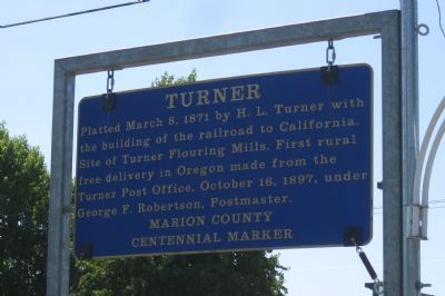
Photographed by Ddtfamily, August 19, 2012
1. Turner Marker
Erected by Marion County.
Topics and series. This historical marker is listed in these topic lists: Notable Places • Settlements & Settlers. In addition, it is included in the Postal Mail and Philately series list. A significant historical date for this entry is March 8, 1913.
Location. 44° 50.588′ N, 122° 57.118′ W. Marker is in Turner, Oregon, in Marion County. It can be reached from Boise Street east of 3rd Street Southeast, on the right when traveling east. Marker is at the northwest corner of Burkland Park. Touch for map. Marker is at or near this postal address: 5273 Boise Street Southeast, Turner OR 97392, United States of America. Touch for directions.

Regionally, this marker is in Oregon Wine Country and in the Willamette Valley. It is also on the American Pacific Coast, in the Pacific Northwest, and in the Lewis & Clark Corridor. Globally, it is in North America,
this page online
Other nearby markers. At least 8 other markers are within 8 miles of this marker, measured as the crow flies: The Circuit Rider / Robert Booth Memorial (approx. 7.6 miles away); Willamette University College of Medicine (approx. 7.6 miles away); Dedicated to You, A Free Citizen in a Free Land (approx. 7.6 miles away); Giant Sequoia (approx. 7.6 miles away); Dr. John McLoughlin (approx. 7.6 miles away); Column Segments (approx. 7.6 miles away); First Trustees of Oregon Institute (approx. 7.6 miles away); Votes For Women (approx. 7.6 miles away).
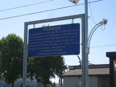
Photographed by Ddtfamily
2. Turner Marker
Credits. This page was last revised on June 16, 2016. It was originally submitted on March 26, 2013, by Ddtfamily of Turner, Oregon. This page has been viewed 698 times since then and 30 times this year. Photos: 1, 2. submitted on March 26, 2013, by Ddtfamily of Turner, Oregon. • Syd Whittle was the editor who published this page.
