Near Croom in Prince George's County, Maryland — The American Northeast (Mid-Atlantic)
Aviation History
Columbia Air Center
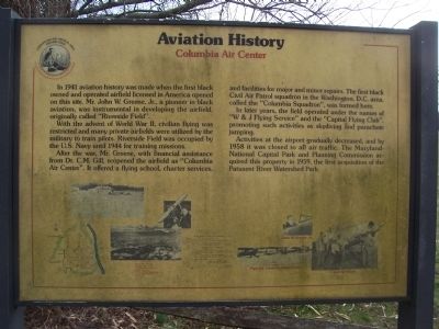
With the advent of World War II, civilian flying was restricted, and many private airfields were utilized by the military to train pilots. Riverside Field was occupied by the U.S. Navy until 1944 for training missions.
After the war, Mr. Greene, with financial support from Dr. C. M. Gill, reopened the airfield as "Columbia Air Center." It offered a flying school, charter services, and facilities for major and minor repairs. The first Black Civil Air Patrol squadron in the Washington, D.C. area, called the "Columbia Squadron," was formed here.
In later years the field operated under the names of "W and J Flying Service" and the "Capital Flying Club," promoting such activities as skydiving and parachute jumping.
Activities at the airport gradually decreased, and by 1958 it was closed to all air traffic. The Maryland-National Capital Park and Planning Commission acquired this property in 1959, the first acquisition of the Patuxent River Watershed Park.
[Photos on marker] Columbia Air Center in operation; John W. Greene, Jr.; his pilot and mechanic licenses; Piper 65, Fairchild, and Taylor aircraft; Civil Air Patrol (Columbia Squadron) members; maps; and "Airport Data".
Erected by the Maryland Department of Natural Resources and the Maryland-National Capital Park and Planning Commission.
Topics. This historical marker is listed in these topic lists: African Americans • Air & Space • War, World II. A significant historical year for this entry is 1941.
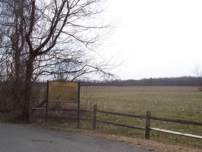
Location. 38° 45.377′ N, 76° 42.342′ W. Marker is near Croom, Maryland, in Prince George's County. Marker is on Chesapeake Bay Critical Area Driving Tour Road, one mile north of Croom Airport Road, on the right. Follow Croom Airport Road to its end at the west perimeter of the old airfield. Proceed north and eastward around the now vacant and cultivated airfield (toward the Patuxent River and Shelby's Landing) via the "Chesapeake Bay Critical Area Driving Tour." The marker will be seen in the first turn-out on the north perimeter of the field. Note that the Chesapeake Bay Critical Area Driving Tour Road is not always open to vehicular traffic, that it is not shown on some maps, and that it is labeled on some maps as Croom Airport Road. Touch for map. Marker is in this post office area: Upper Marlboro MD 20772, United States of America. Touch for directions.
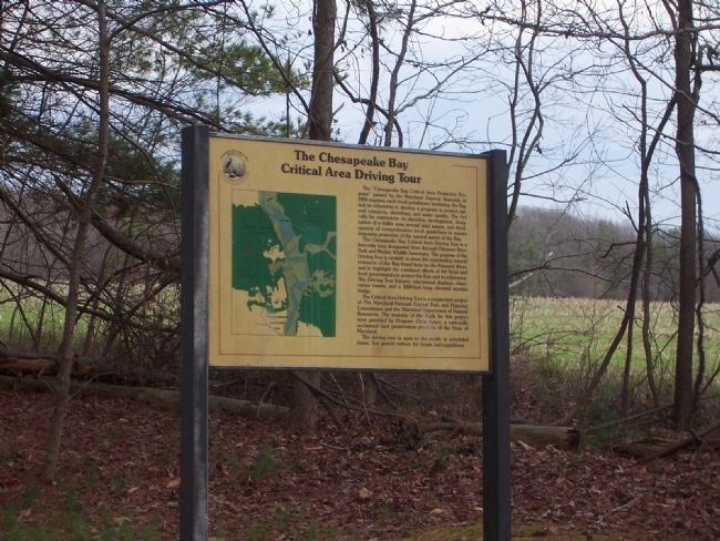
Other nearby markers. At least 8 other markers are within walking distance of this marker. The Chesapeake Bay Critical Area Driving Tour (approx. ¼
mile away); Columbia Air Center (approx. ¼ mile away); The Cloud Club (approx. 0.3 miles away); The Compass Rose (approx. 0.3 miles away); John W. Greene (approx. 0.3 miles away); Eastern Bluebird (approx. 0.3 miles away); Man and the River (approx. 0.4 miles away); Woodland Indian Villages on the Patuxent River (approx. 0.4 miles away). Touch for a list and map of all markers in Croom.
Credits. This page was last revised on November 22, 2019. It was originally submitted on March 19, 2008, by Richard E. Miller of Oxon Hill, Maryland. This page has been viewed 2,132 times since then and 7 times this year. Photos: 1, 2, 3. submitted on March 19, 2008, by Richard E. Miller of Oxon Hill, Maryland. 4. submitted on October 31, 2009, by Richard E. Miller of Oxon Hill, Maryland. • Christopher Busta-Peck was the editor who published this page.


