Victorville in San Bernardino County, California — The American West (Pacific Coastal)
Mormon Springs
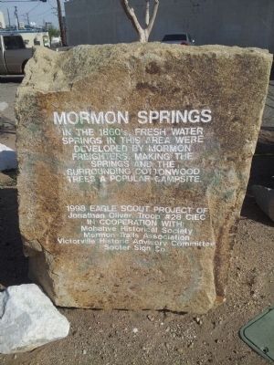
Photographed by Richard Hawkins, March 25, 2013
1. Mormon Springs Marker
Erected 1998 by Eagle Scout Project-Jonathan Oliver, Mohave Historical Society, Mormon Trails Assn., Victorville Historical Adv. Comm. and Sooter Sign Co.
Topics. This historical marker is listed in these topic lists: Natural Resources • Settlements & Settlers.
Location. 34° 32.095′ N, 117° 17.58′ W. Marker is in Victorville, California, in San Bernardino County. It is at the intersection of 8th Street and C Street, on the right when traveling south on 8th Street. Touch for map. Marker is at or near this postal address: 15314 8th Street, Victorville CA 92395, United States of America. Touch for directions.

Regionally, this marker is in Greater Los Angeles, in the Peninsular Ranges, and specifically in the Transverse Ranges. It is also in the American Southwest. Globally, it is in North America, on the Ring of Fire, on the Pacific Rim, in the Western Hemisphere, in the Western World, and in the
this page online
Other nearby markers. At least 8 other markers are within 5 miles of this marker, measured as the crow flies: California Route 66 Museum, Victorville, California (approx. 0.2 miles away); Old Town Victorville Veterans Memorial (approx. ¼ mile away); Emma Jean's (approx. 2.2 miles away); Mojave River Crossing (approx. 3.6 miles away); Lane's Crossing (approx. 3.6 miles away); Family Home of B.J. Westlund, then Roy Rogers (approx. 3.6 miles away); Palisades Ranch Museum (approx. 3.6 miles away); Thorn Train Siding (approx. 4.4 miles away). Touch for a list and map of all markers in Victorville.
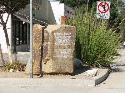
Photographed by Denise Boose, September 14, 2010
2. Mormon Springs Marker

Photographed by Richard Hawkins, July 17, 2016
3. Mormon Springs Marker
Credits. This page was last revised on March 11, 2025. It was originally submitted on March 27, 2013, by Richard Hawkins of Phelan, California. This page has been viewed 1,558 times since then and 44 times this year. Photos: 1. submitted on March 27, 2013, by Richard Hawkins of Phelan, California. 2. submitted on May 9, 2014, by Denise Boose of Tehachapi, California. 3. submitted on July 18, 2016, by Richard Hawkins of Phelan, California. • Syd Whittle was the editor who published this page.
