Coalinga in Fresno County, California — The American West (Pacific Coastal)
Liberty “Airdome Theater”
Built in 1904 – Terminated with the advent of “talkies” and evaporating coolers.
Photographed by Barry Swackhamer, March 22, 2013
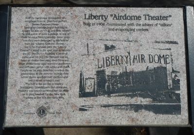
1. Liberty “Airdome Theater” Marker
Inscription.
Built by Dominique Bordagaray, who emigrated from St. Jean Pied de Port, Basses Pyrenees France. Soon after Coalinga began building he bought six lots on “C” St. and fifth, where he built a row of store buildings. In one of these he ran a French laundry. Some years later they were destroyed by fire and he built the “Liberty Airdome Theater.” Not to be confused with the “Liberty Theater” it stood in the spot later to become the J.C. Penney Co. building (Corner of Cedar and 5th St.). The Airdome was an open air theater featuring silent films and stage productions, cigar stand for gentlemen and ice cream parlor with tables and chairs. People sat on slats (benches) to watch the productions. In the summer months they would throw sawdust over the floor and wet it down to keep it cool. The boy in the picture is Stanley Bordagaray, Dominique’s 2nd oldest son. Stanley was known as “Frenchie” an(d) went on to play baseball for the New York Yankees in the 30’s and early 40’s.
Erected by Coalinga Lions Club.
Topics. This historical marker is listed in this topic list: Entertainment.
Location. 36° 8.464′ N,
Click or scan to see this page online
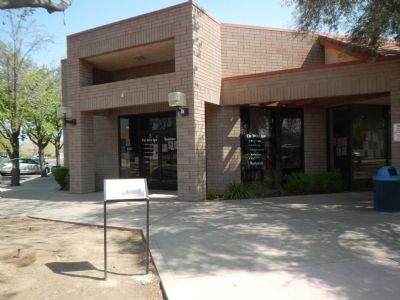
120° 21.736′ W. Marker is in Coalinga, California, in Fresno County. It is at the intersection of Coalinga Plaza (North 5th Street) and East Cedar Avenue, on the right when traveling north on Coalinga Plaza (North 5th Street). Touch for map. Marker is at or near this postal address: 398 Coalinga Plaza, Coalinga CA 93210, United States of America. Touch for directions.
Regionally, this marker is in the San Joaquin Valley, specifically in the Central Valley, and in the Sierra Nevada. It is also on the American Pacific Coast. Globally, it is in North America, on the Ring of Fire, on the Pacific Rim, in the Western Hemisphere, in the Western World, and in the Anglosphere. Historically, it finds itself in what was once New Spain and also Mexico’s Alta California.
Other nearby markers. At least 8 other markers are within walking distance of this marker: The Bertrich Block (a few steps from this marker); The Phelps Building (within shouting distance of this marker); B.M. Food Market (within shouting distance of this marker); Coalinga Woman’s Club (within shouting distance of this marker); “Dr. Bill” (within
Credits. This page was last revised on June 16, 2016. It was originally submitted on March 29, 2013, by Barry Swackhamer of Brentwood, California. This page has been viewed 944 times since then and 32 times this year. Photos:1, 2. submitted on March 29, 2013, by Barry Swackhamer of Brentwood, California. • Syd Whittle was the editor who published this page.