Coalinga in Fresno County, California — The American West (Pacific Coastal)
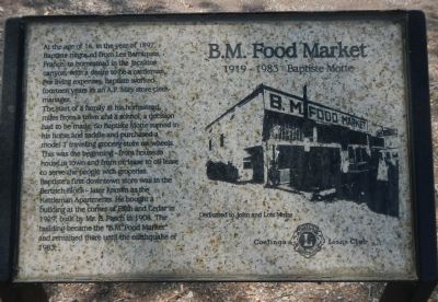
B.M. Food Market
1919-1983 Baptiste Motte
Photographed by Barry Swackhamer, March 22, 2013
1. B.M. Food Market Marker
The start of a family at his homestead, miles from a town and a school, decision had to be made. So Baptiste Motte turned in his horse and saddle and purchased a model T traveling grocery store on wheels. This was the beginning – from house to house in town and from oil lease to oil lease to serve the people with groceries
Baptiste’s first downtown store was in the Bertrich Block – later known as the Kettleman Apartments. He bought a building at the corner of Fifth and Cedar in 1929, built by Mr. B. Pasch in 1908. The building became the “B.M. Food Market” and remained there until the earthquake of 1983.
Dedicated to John and Lois Motte
Erected by Coalinga Lions Club.
Topics. This historical marker is listed in these topic lists: Industry & Commerce • Notable Buildings. A significant historical year for this entry is 1897.
Location. 36° 8.466′ N, 120° 21.76′ W.
this page online

Regionally, this marker is in the San Joaquin Valley, specifically in the Central Valley, and in the Sierra Nevada. It is also on the American Pacific Coast. Globally, it is in North America, on the Ring of Fire, on the Pacific Rim, in the Western Hemisphere, in the Western World, and in the Anglosphere. Historically, it finds itself in what was once New Spain and also Mexico’s Alta California.
Other nearby markers. At least 8 other markers are within walking distance of this marker: The Phelps Building (a few steps from this marker); The Bertrich Block (within shouting distance of this marker); Liberty “Airdome Theater” (within shouting distance of this marker); “Dr. Bill” (within shouting distance of this marker); Coalinga Woman’s Club (within shouting distance of this marker); Pleasant Valley Hotel (about 400 feet away,
Photographed by Barry Swackhamer, March 22, 2013
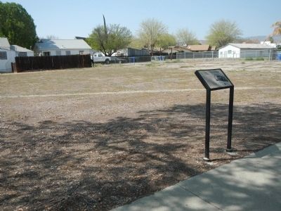
2. B.M. Food Market Marker
Credits. This page was last revised on June 16, 2016. It was originally submitted on March 29, 2013, by Barry Swackhamer of Brentwood, California. This page has been viewed 855 times since then and 28 times this year. Photos: 1, 2. submitted on March 29, 2013, by Barry Swackhamer of Brentwood, California. • Syd Whittle was the editor who published this page.
